May 2024 Climate Summary
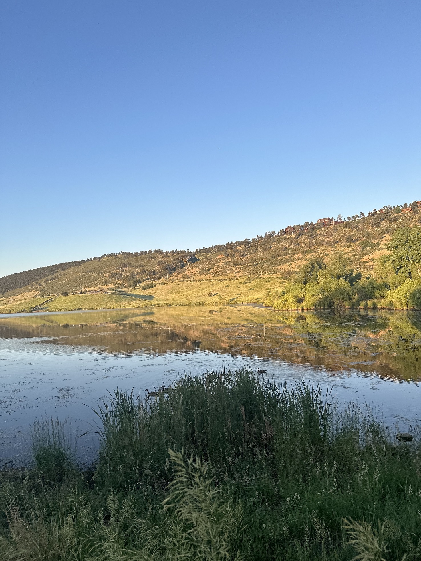
Foothills near Fort Collins, Colorado, Photo Courtesy of Gannon Rush
Regional Breakdown
May featured a steady stream of severe weather, with Kansas and Nebraska hit the hardest. More tornadoes struck Nebraska, while Kansas received large hail and exceptionally strong winds. Nearly all weather phenomena were experienced in the region this month, with parts of North Dakota receiving snow late in the month.
Kansas was pummeled by large hail this month, with two days featuring stones over 4 inches (10.16 cm). A destructive derecho also impacted the central part of the state on the 19th, uprooting trees and destroying buildings. Winds reached 100 mph (161 km/h) in Salina and were above 60 mph (97 km/h) as far east as Kansas City.
Although there have been numerous tornadoes this month in Nebraska, the maximum rating was an EF2 near Lake McConaughy on the 23rd. A preliminary total of 34 were reported this month, more than double their average of 15. Through the end of May, 81 have been reported, which is nearly 30 more than the yearly average at this point of the year. With June being the peak of tornadic activity in the state, they could position themselves to break their annual record this year.
The steady stream of storms finally led to flooding late in the month. Nearly 7 inches (17.78 cm) of rain fell in parts of a small area across eastern Nebraska stretching from David City to Omaha. Roads were closed, and cars were left stranded due to the flash flooding.


Precipitation and Water Resources
Precipitation in May was typical of springtime, scattered but also abundant. The areas that did receive rainfall were often over 150 percent of their normal, with some localized amounts exceeding 10 inches this month.
The late April tornado outbreak in eastern Nebraska transitioned into a very wet month for that part of the state. This active pattern peaked on the 21st when a particularly heavy band of precipitation dropped large amounts of rain. Fremont recorded their 2nd highest single-day total of 6.32 inches (16.05 cm) and the 4th wettest month in their 131-year record. Nearby, Omaha was also impacted by the heavy rainfall and observed 11.13 inches (28.27 cm) to fall just shy of their wettest May on record.
Parts of the Dakotas also received above-normal precipitation, with areas recording more than 7 inches. Sisseton, South Dakota ranked 6th wettest this month, with 5.69 inches (14.45 cm) falling. Across the border, in North Dakota, Fargo placed 8th with 5.92 inches (15.04 cm).
Among those who missed out this month were the areas in and around Cheyenne, Wyoming. The city only measured 0.34 inches (8.64 mm) to rank 7th driest. Nearby Laramie fared slightly better with 0.57 inches (14.48 mm) but also ranked 7th.
Streamflow is in very good shape across the region except for central and western Kansas. Some precipitation has occurred there recently; however, it is not optimal amounts. In the eastern part of the region, streamflow in the Missouri River is near or at record level, creating the concern of flooding.


Temperatures
Temperatures were split across the region, with the west below and the east above normal this month. Parts of northwestern Colorado were 5 to 7 degrees F (2.8 to 3.9 degrees C) below normal, thanks to exceptionally cool minimum temperatures. Overall, there were no major locations that ranked in the top 10 for May.
Average minimum temperatures across Colorado were slightly below normal, however, portions west of the Rockies were near or at record lows. Towns such as Meeker were nearly 8 degrees F (4.4 degrees C) below their normal average lows, which also extended into parts of southwestern Wyoming. Despite the cooler temperatures, there were no records broken.
This spring was rather warm across Kansas, with many locations ranking among the warmest. Concordia and Topeka ranked 3rd, while Wichita tied for 4th. To the west, Dodge City ranked 7th. Outside of a few minor heatwaves, temperatures in Kansas remained consistently slightly above normal. Elsewhere in the region, Laramie, Wyoming recorded their 4th warmest Spring and Fargo, North Dakota tied for 7th.
Drought Conditions
The continual rounds of heavy precipitation have greatly improved drought conditions across the High Plains in recent months. Some parts of the west experienced degradation this month, but the region saw a reduction of over 9 percent in D0 to D4 (abnormally dry to exceptional drought conditions).
The drought that had gripped Nebraska since 2021 is nearly erased. D2 (severe drought) has been eliminated from the state for the first time since June 1st, 2021. This is also a drastic shift from last year when close to 11 percent of the state was engulfed by D4. Conditions are likely to continue to improve in the state, with standing water common across the eastern part of the state.
Near-record precipitation in North Dakota led to significant improvements, with D0-D4 reduced by 29 percent this month. Only a small sliver of drought conditions remains in the western border, with over 80 percent of the state drought-free.
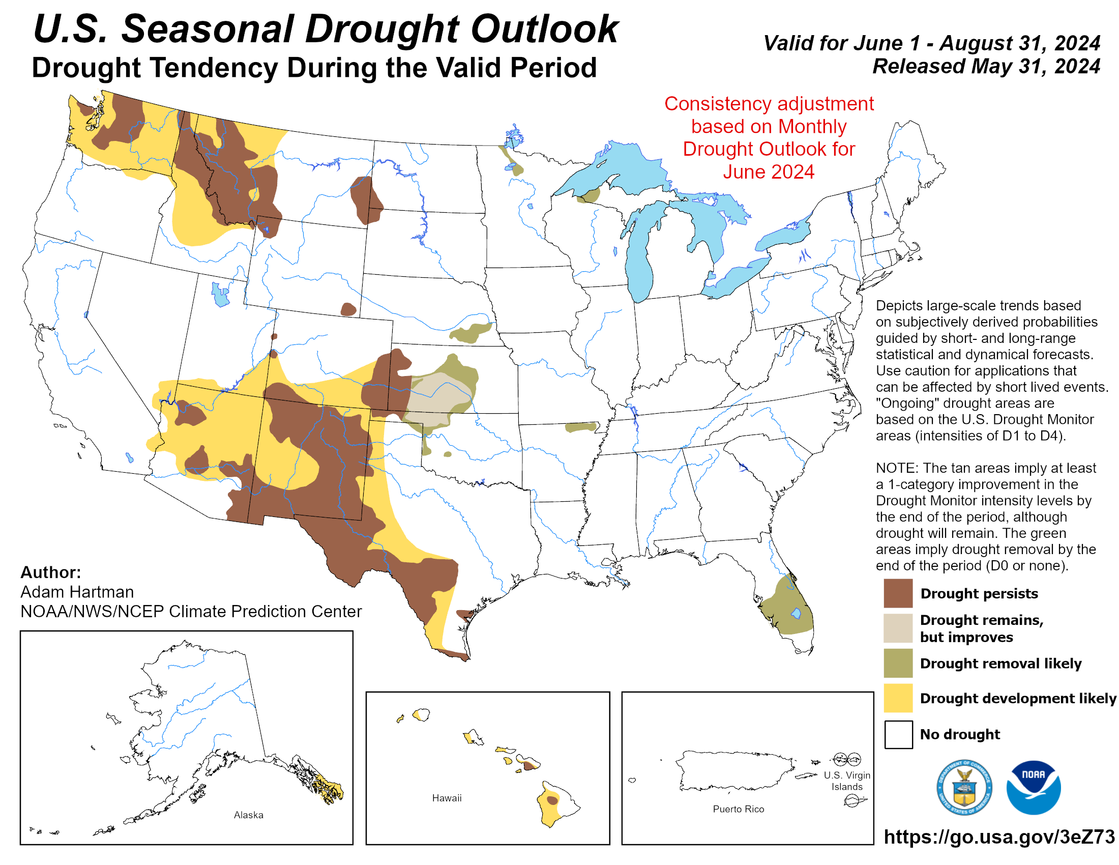
The lone source of concern, once again, in the region is western Kansas. Two small patches of D3 (extreme drought) were reintroduced, but it could be short-lived due to recent rains. Elsewhere in the region, other improvements and degradation were observed. According to the Climate Prediction Center’s U.S. Monthly Drought Outlook for June, drought conditions will improve in parts of Kansas and Nebraska but develop in southwestern Colorado.


Department of Agriculture (USDA), National Drought Mitigation
Center, U.S. Department of Commerce, and the National Oceanic and
Atmospheric Administration (NOAA). For current Drought Monitor
information, please see: http://droughtmonitor.unl.edu/
Climate Outlooks
According to the Climate Prediction Center, El Niño conditions are likely to end soon with a transition to ENSO-neutral. An El Niño advisory and La Niña watch is currently in effect. For more information, visit https://www.cpc.ncep.noaa.gov/products/analysis_monitoring/lanina/enso_evolution-status-fcsts-web.pdf
The National Weather Service’s long-range flood outlook indicates elevated chances of Minor and Moderate Flooding in Nebraska and Kansas along the Missouri River through August. According to the National Interagency Fire Center (NIFC), fire potential will be elevated in eastern Colorado and western Kansas in July and August.
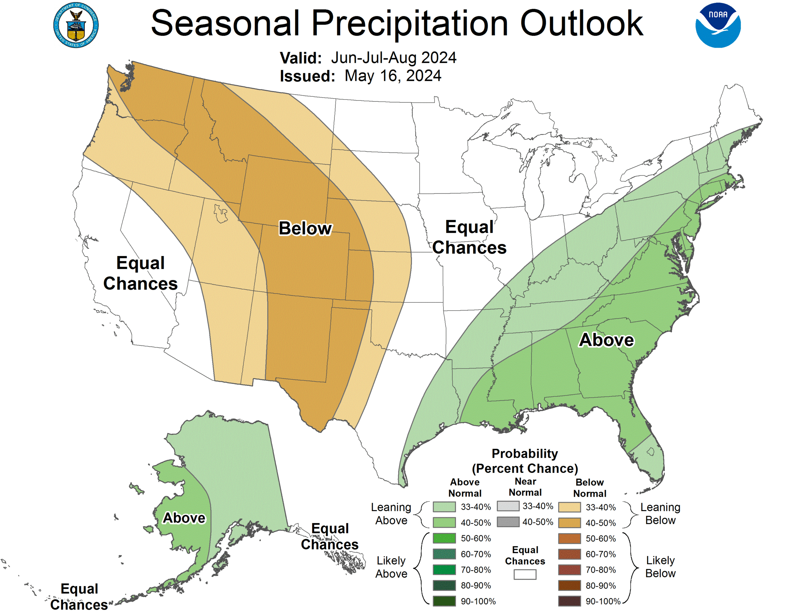
The seasonal temperature and precipitation outlook presented below combine the effects of long-term trends, soil moisture, and when applicable, the El Niño Southern Oscillation (ENSO). To learn more about these outlooks, please visit http://www.cpc.ncep.noaa.gov.
Temperature
The three-month temperature outlook shows an increased chance of above-normal temperatures across the much of the United States. Above-normal temperatures are slightly favored across Colorado, Kansas, Nebraska, and Wyoming.

Precipitation
The outlook for the next three months indicates below-normal precipitation across the west-central United States, while above-normal is possible in the east. Below-normal precipitation is possible in nearly every state in the High Plains.
Drought
The U.S Seasonal Drought Outlook released on May 31st indicates that improvements to drought conditions will occur across the region except for Colorado, where development is possible.
Station Summaries: By the Number


Download PDF
