

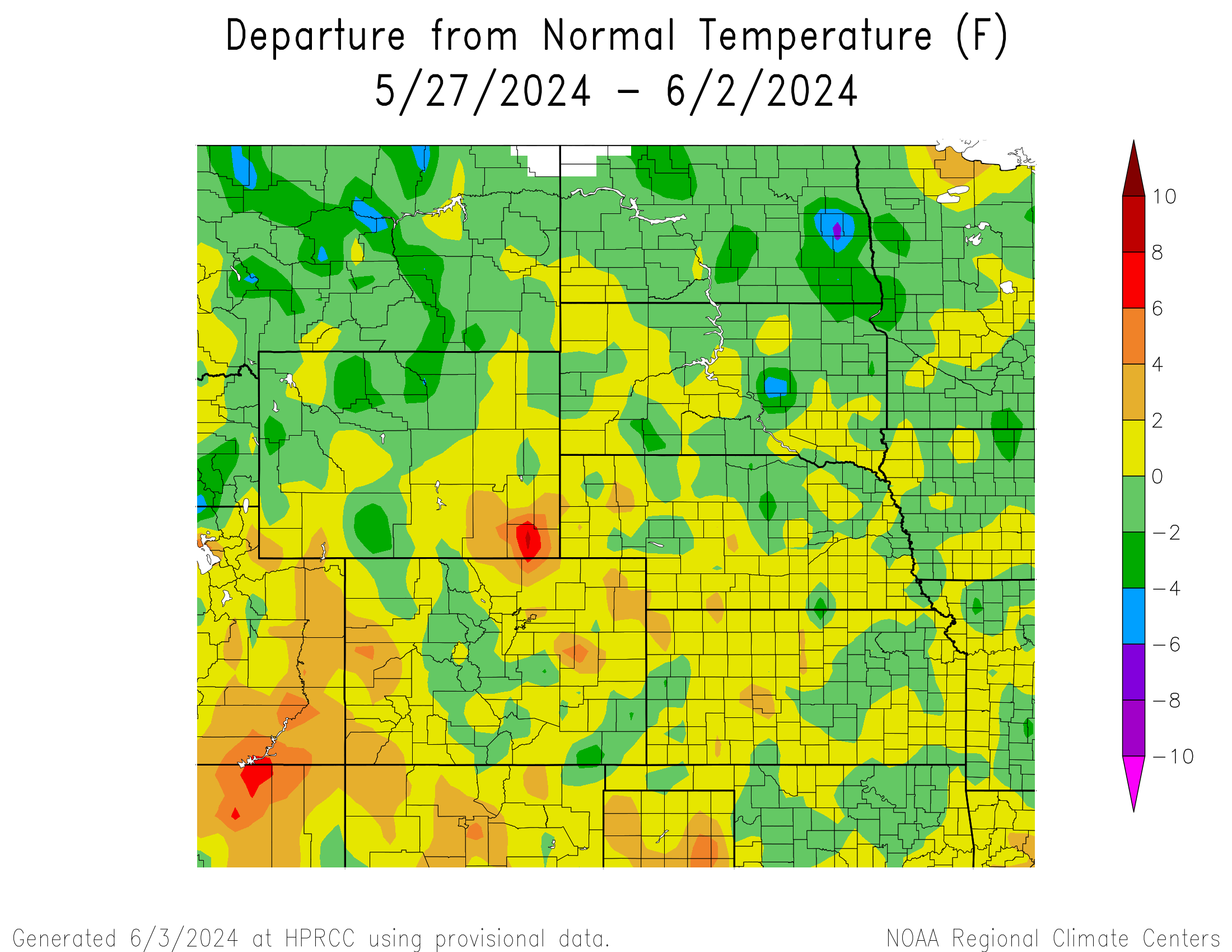
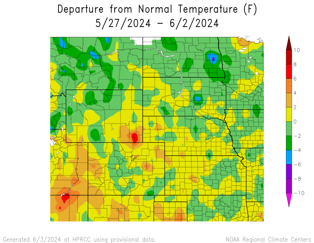
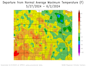
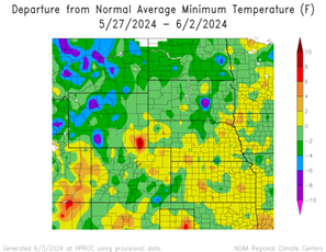
Temperature
This week featured below normal temperatures for a majority of the region. The coldest regions include a spot in eastern North Dakota, and a spot in central South Dakota with temperatures of 4°F to 8°F below. The warmest region was the southeastern corner of Wyoming with temperatures of 6°F to 10°F.
Maximum temperatures were 4°F to 6°F above normal for a majority of Wyoming and Colorado with some areas within those states reaching 6°F to 8°F above normal. The warmest temperature was in Grand Junction, Colorado with 89°F which is 6°F above normal for the area. Temperatures in eastern North Dakota were 4°F to 8°F below normal.
Minimum temperatures were 4°F to 10°F below normal in Wyoming, eastern North Dakota, southeastern Colorado, and central South Dakota. The coldest temperature was in Casper, Colorado with 38°F which is 3°F below normal for the area. The southeastern corner of Wyoming was 4°F to 11°F above normal.
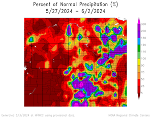
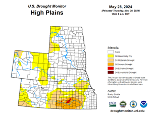
Precipitation
Precipitation amounts varied this week, ranging from 5% of normal precipitation for a majority of Wyoming, western and central Colorado, northern North Dakota, central South Dakota, and north central Nebraska to 300% of normal in eastern Colorado, western Kansas, and northeastern Nebraska. Elgin, Nebraska received 4.55 inches of rain, well above their normal of 0.15 inches; most of this fell on May 31st. Drought continues in the region. D0 (abnormally dry) across the region was down from 34% to 33%. Inside the region, North Dakota experienced the highest decrease in D0 conditions with a 5% decrease.
Severe Storms
Nebraska, North Dakota and Wyoming received hail with diameters between 1 to 2 inches. Colorado and South Dakota received hail with diameters between 1 and 2.75. Kansas received hail with diameters between 1 to 3 inches.