

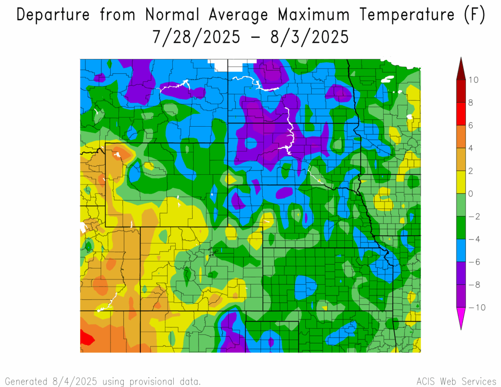
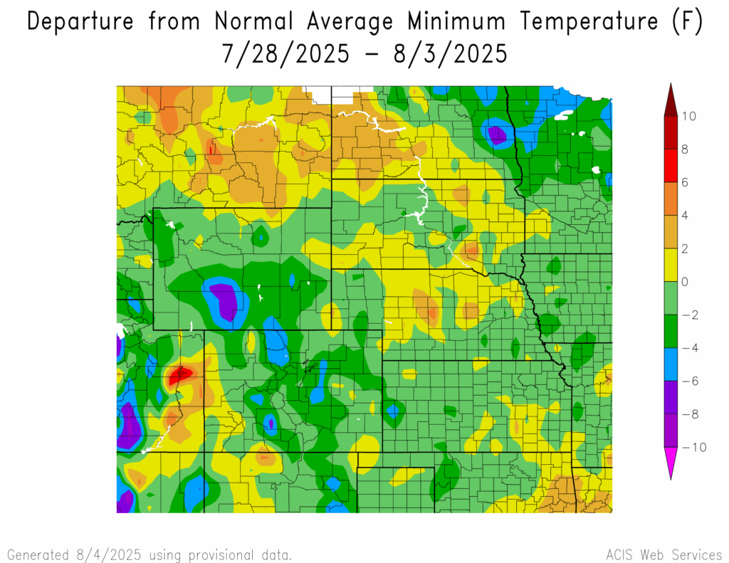
Temperature
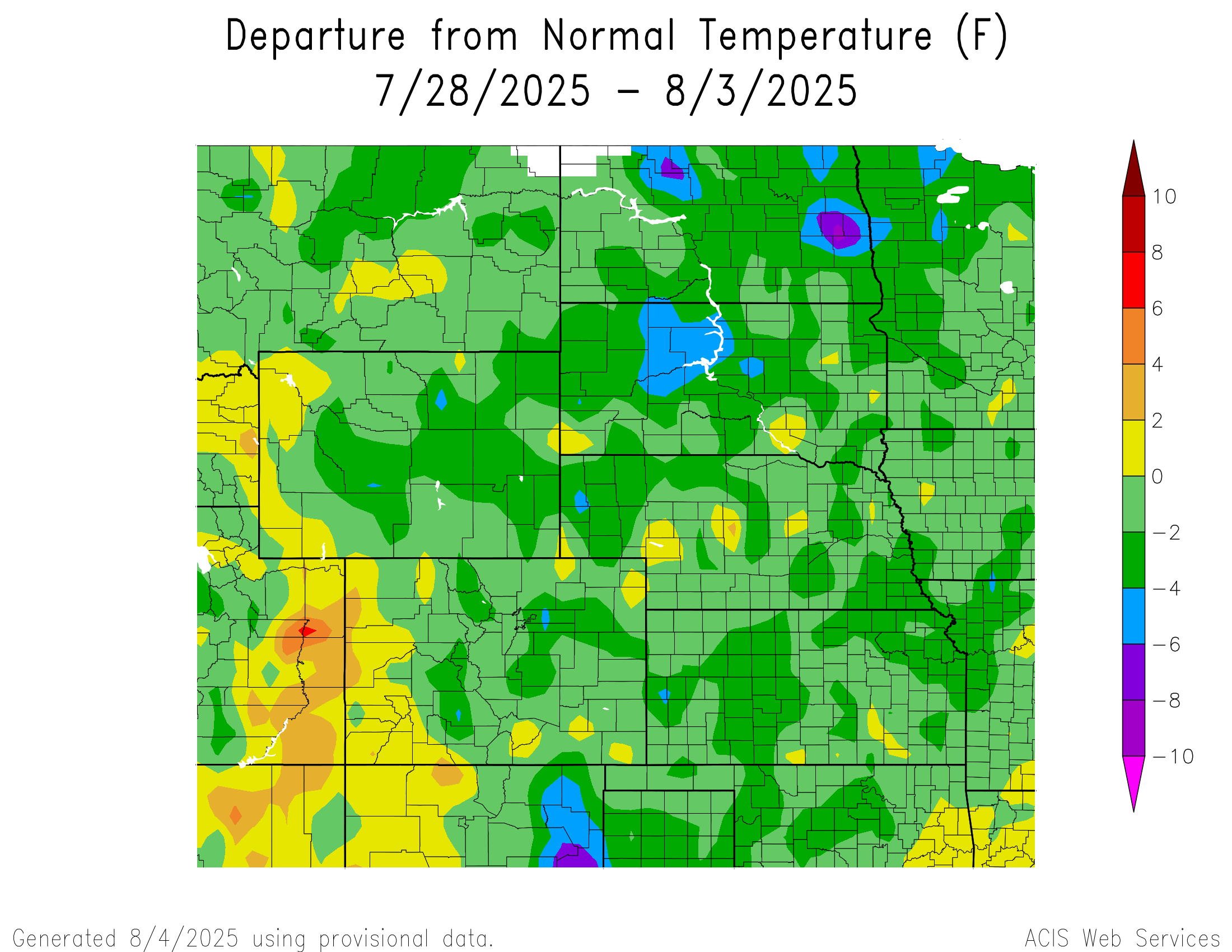
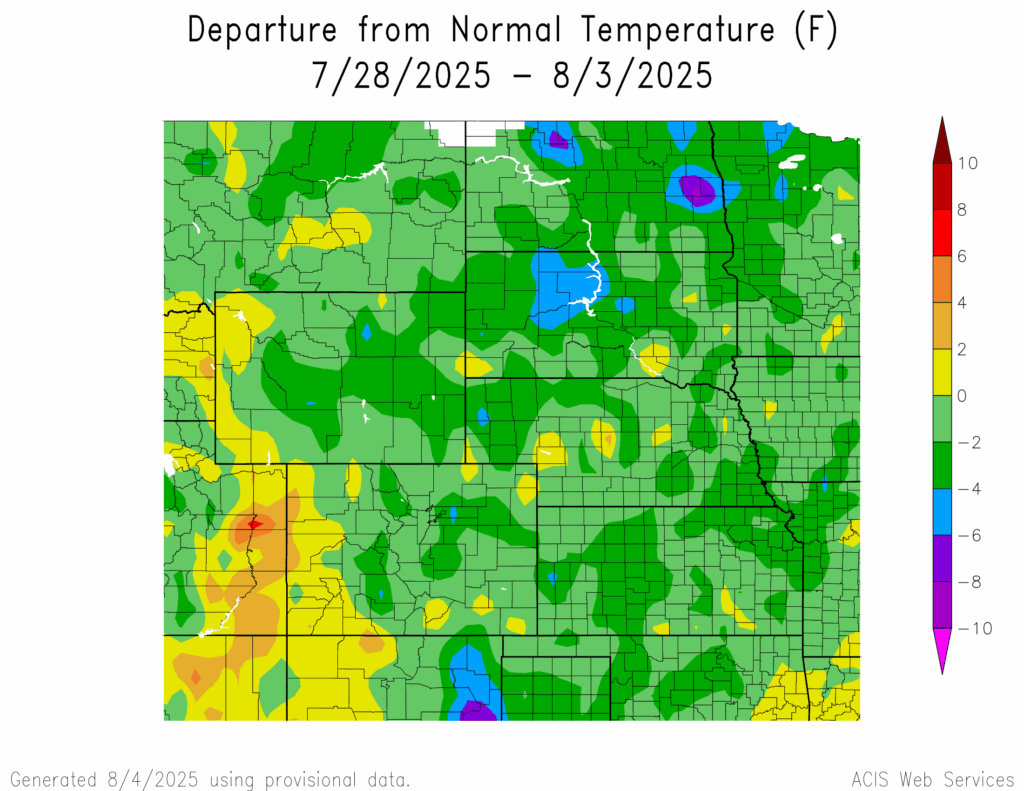
Temperatures were below normal in the majority of the region. The lowest temperatures were 6°F to 8°F below normal in northern and eastern North Dakota, with an area in eastern North Dakota reaching 8°F to 10°F below normal. The highest temperatures were 2°F to 4°F above normal in western Colorado and a small area in central Nebraska.
Temperatures in northwestern Wyoming and southwestern Colorado reached 4°F to 6°F above normal. The hottest temperature was 95°F at Grand Junction, Colorado, which is 1°F above normal for the area. The lowest temperatures were 8°F to 10°F below normal in eastern and western North Dakota, and central and northwestern South Dakota.
Temperatures in eastern North Dakota, southcentral Wyoming, and southcentral Colorado reached 6°F to 8°F below normal. The coldest temperature was 44°F at Laramie, Wyoming, which is 3°F below normal for the area. The highest temperatures were 4°F to 6°F above normal in central Nebraska and southeastern South Dakota.
Precipitation
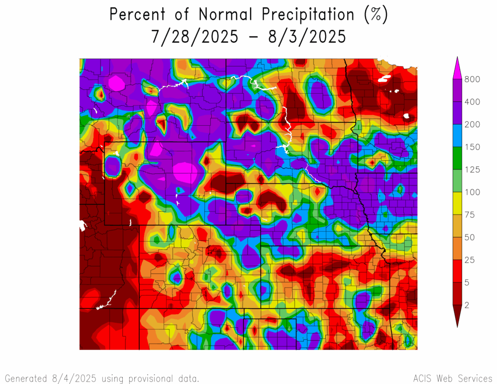
Precipitation amounts varied this week, ranging from 2 percent of normal across central Kansas, scattered parts of central Colorado, western Wyoming, western Nebraska, along the Wyoming-South Dakota-Nebraska border, northwestern South Dakota, central and eastern North Dakota to 800 percent of normal in central and northern Wyoming and a small spot in western South Dakota. Castlewood, South Dakota received 6.56 inches of precipitation; most of it fell on the 28th. Drought continues in the region. D0 (abnormally dry) conditions decreased from 54 percent to 49 percent. In the region, each state experienced a decrease in D0 conditions with Kansas experiencing the highest decrease in D0 conditions by 15 percent.
Severe Storms
North Dakota received hail 1 to 1.25 inches in diameter. Nebraska and Wyoming received hail 1 to 2.5 inches and 1 to 3 inches in diameter, respectively. Colorado, Kansas, and South Dakota received hail 1 to 2.74 inches in diameter.