

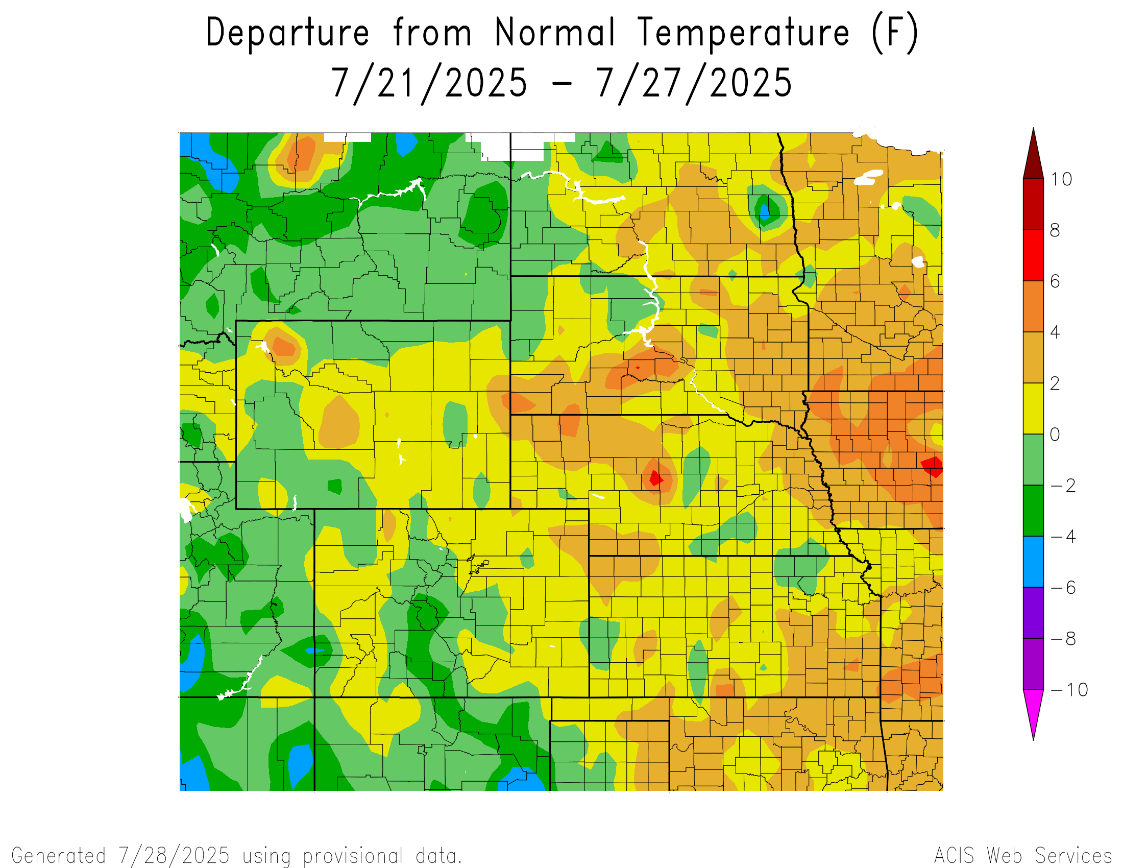
Temperature
Temperatures varied across the region. The highest temperatures were 6°F to 8°F above normal in central Nebraska and a spot in central South Dakota. The lowest temperatures were 4°F to 6°F below normal in eastern North Dakota and a small spot in southwestern Colorado.
Temperatures in southwestern South Dakota and northwestern Nebraska reached 6°F to 8°F above normal. The hottest temperature was 95°F at Pueblo, Colorado, which is 2°F above normal for the area. The coldest temperatures were in eastern North Dakota reaching 6°F to 8°F below normal.
Temperatures in southcentral Wyoming, and southcentral and southwestern Colorado reached 4°F to 6°F below normal. The coldest temperature was 46°F at Alamosa, Colorado, which is 2°F below normal for the area. The highest temperatures were 6°F to 8°F above normal in central and a small spot in eastern Nebraska, central and eastern South Dakota, and southeastern Kansas, with central Nebraska reaching temperatures 8°F to 10°F above normal.
Precipitation
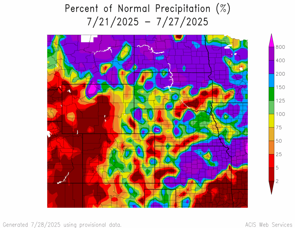
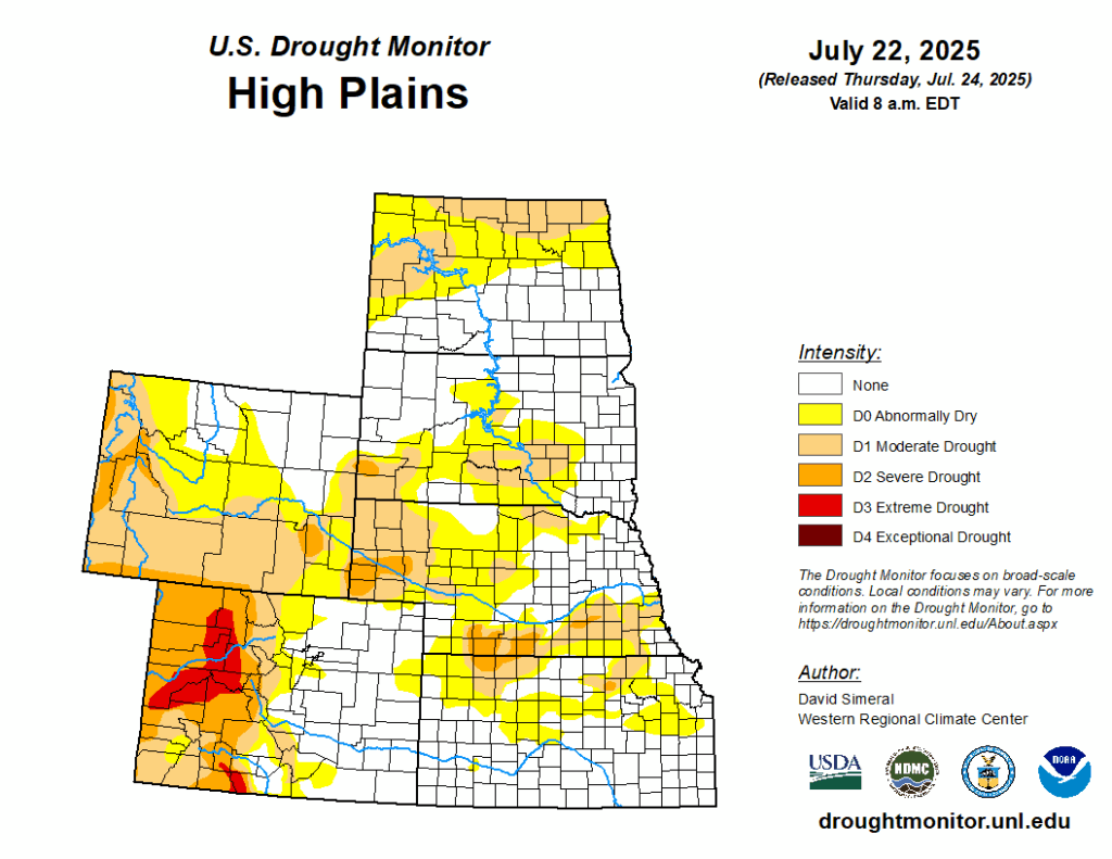
Precipitation amounts varied in the region, ranging from 2 percent of normal in the southern corners of Kansas, western and eastern Colorado, central and western Wyoming, scattered parts of central Nebraska, southeastern South Dakota, and northcentral North Dakota to 800% of normal in northcentral Wyoming. Kanopolis Lake, Kansas received 7.04 inches of precipitation; most of it fell on the 22nd. Drought continues in the region. D0 (abnormally dry) conditions decreased from 56 percent to 54 percent. In the region, Kansas experienced the highest decrease in D0 conditions by 7 percent while North Dakota experienced the highest increase in D0 conditions by 3 percent.
Severe Storms
Colorado and Wyoming received hail 1 to 1.25 inches in diameter. Kansas and North Dakota received hail 1 to 1.75 inches in diameter. Nebraska and South Dakota received hail of 1 to 2.5 inches and 1 to 4.5 inches in diameter, respectively.