


Temperature
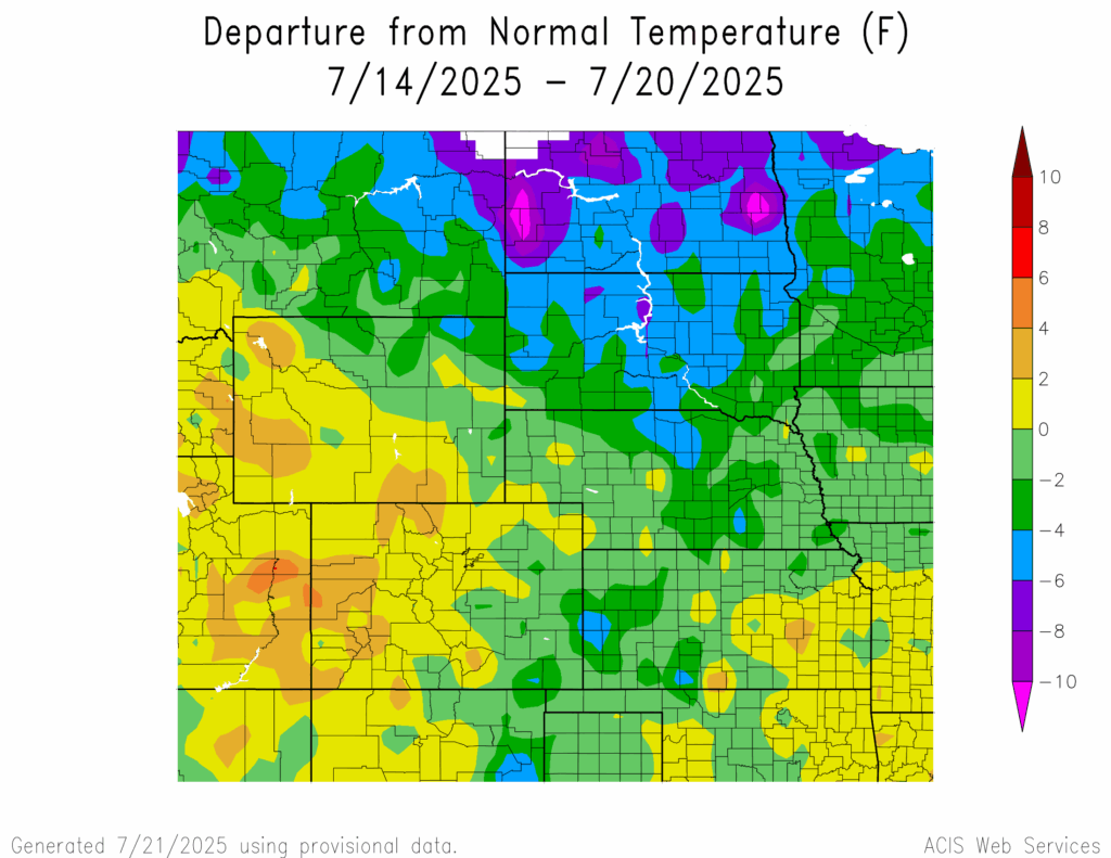
Temperatures were below normal across the central and northern parts of the region. The lowest temperatures were greater than 10°F below normal in western and eastern North Dakota. The highest temperatures were 4°F to 6°F above normal in western Colorado.
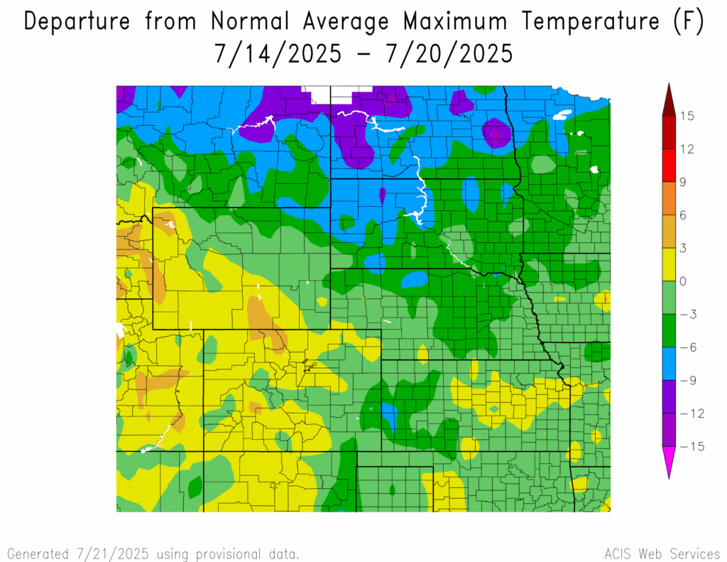
Temperatures in western Kansas, northern Nebraska, western and northeastern South Dakota, and across North Dakota reached 6°F to 9°F below normal with areas in North Dakota and a spot in northwestern South Dakota reaching 9°F to 15°F below normal. The highest temperatures were 3°F to 6°F above normal in central and northcentral Colorado, and southeastern and western Wyoming.
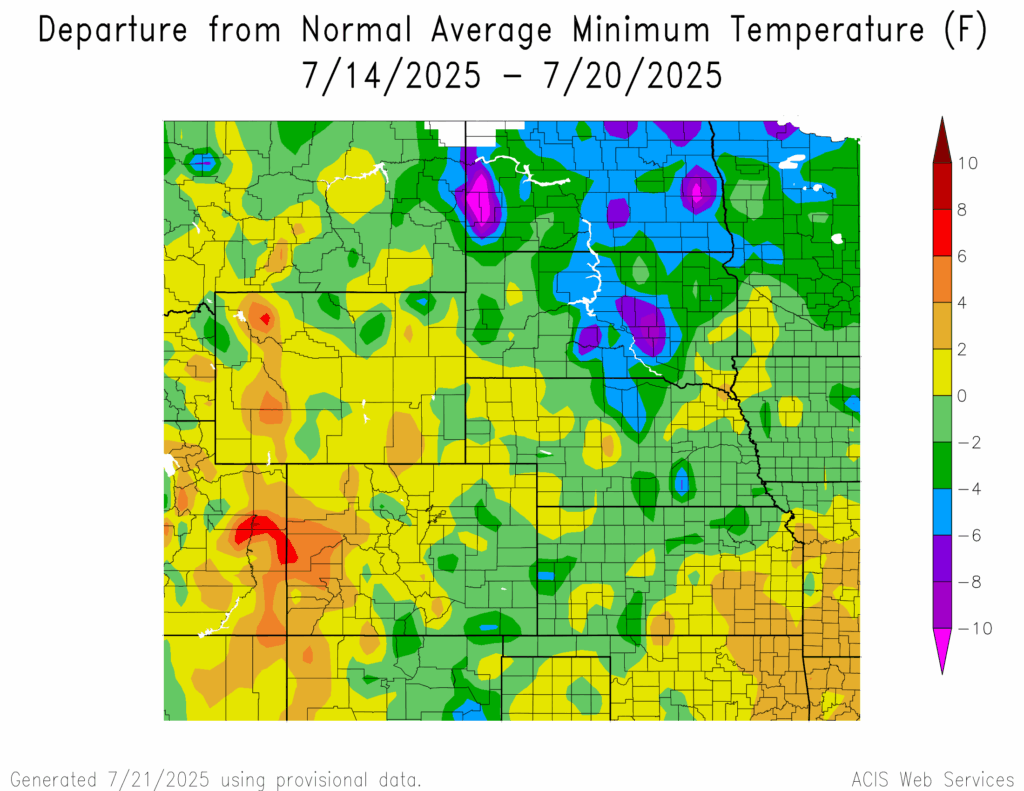
Temperatures in western Colorado and northwestern Wyoming reached 6°F to 8°F above normal. The lowest temperatures were greater than 10°F below normal in western and eastern North Dakota.
Precipitation
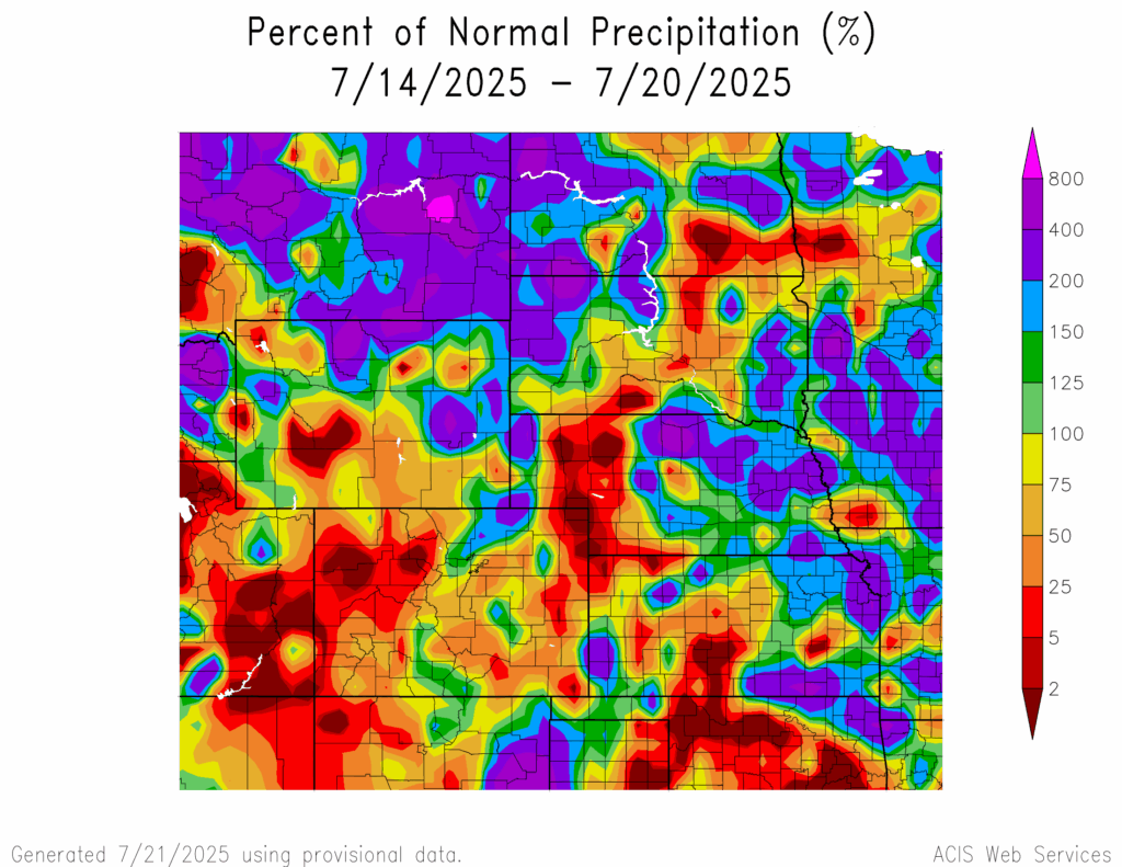
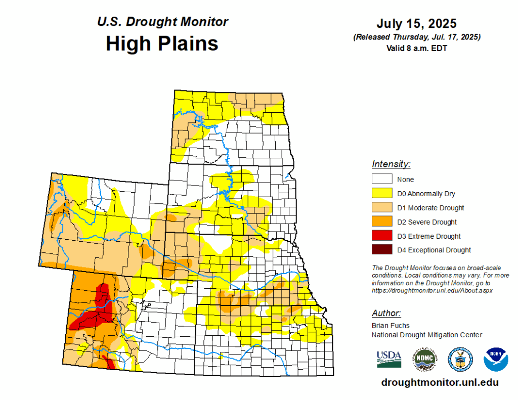
Precipitation amounts varied in the region, ranging from 2 percent of normal in southcentral Kansas, western Nebraska, across central South Dakota, southcentral North Dakota, central and spots of northern Wyoming, and western Colorado to 400 percent of normal in southeastern Kansas, northcentral Nebraska, northwestern South Dakota, western North Dakota, and northcentral Wyoming. Kansas City, Kansas received 6.48 inches of precipitation; most of it fell on the 17th. Drought continues in the region. D0 (abnormally dry) conditions decreased from 57 percent to 56 percent. In the region, Nebraska experienced the highest decrease in D0 conditions by 18 percent while Wyoming experienced the highest increase in D0 conditions by 13 percent.
Severe Storms
Wyoming and Kansas received hail of 1 to 1.2 inches and 1 to 1.75 inches in diameter, respectively. Colorado and North Dakota received hail of 1 to 2 inches and 1 to 2.25 inches in diameter, respectively. Nebraska and South Dakota received hail of 1 to 4 inches in diameter.