

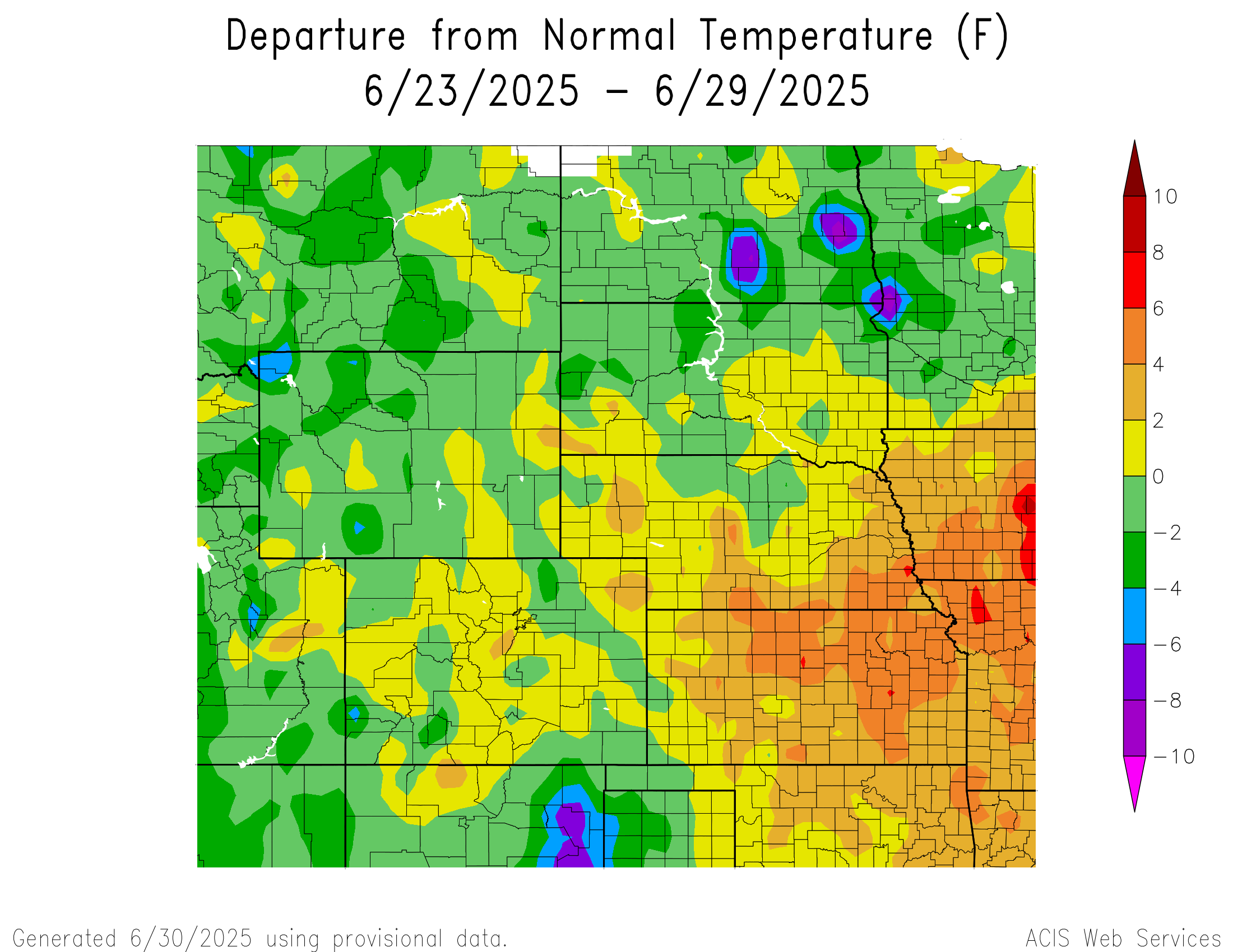
Temperature
Temperatures in central and eastern North Dakota reached 6°F to 10°F below normal. Southern Nebraska and central and eastern Kansas reached temperatures 4°F to 6°F above normal, with some areas in those regions reaching temperatures 6°F to 8°F above normal.
Temperatures in central and southwestern South Dakota, northcentral Colorado, southeastern Nebraska and across central Kansas reached temperatures 4°F to 6°F above normal. The hottest temperature was 93°F at Grand Junction, Colorado, which is 1°F above normal for the area. The coldest temperatures were greater than 10°F below normal in eastern North Dakota.
Temperatures in southcentral North Dakota reached 8°F to 10°F below normal. The coldest temperature was 46°F at Casper, Wyoming, which is 2°F below normal for the area, and at Sheridan, Wyoming, which is 3°F below normal for the area. The warmest temperatures were 6°F to 8°F above normal across central and eastern Kansas and southern Nebraska.
Precipitation
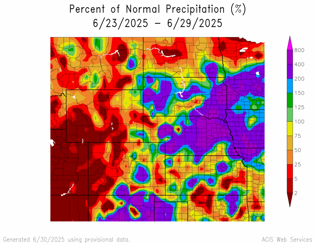
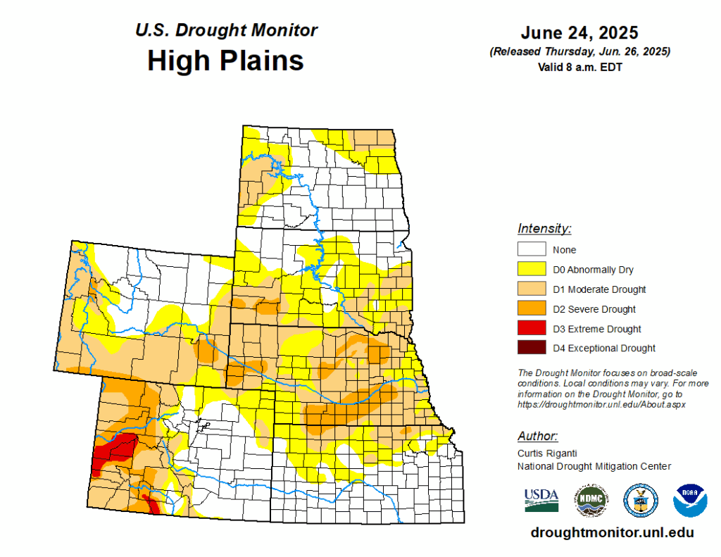
Precipitation amounts varied in the region, ranging from 2 percent of normal in western Colorado, across a majority of Wyoming, scattered parts of Kansas, the Nebraskan panhandle, and central North Dakota to 400 percent of normal across central Nebraska, eastern South Dakota, and southcentral Colorado. Brookings, South Dakota received 6.34 inches of precipitation; most of it fell on the 29th. Drought continues in the region. D0 (abnormally dry) conditions remained the same as the previous week. In the region, Kansas experienced a decrease in D0 conditions by 2 percent while North Dakota experienced an increase in D0 conditions by 4 percent.
Severe Storms
Colorado and Kansas received hail of 1 inch diameter and 1 to 1.25 inches in diameter, respectively. Wyoming and Nebraska received hail from 1 to 1.75 inches in diameter and 1 to 2.3 inches in diameter, respectively. North Dakota received hail from 1 to 2.75 inches in diameter and reported multiple tornadoes, 10 of which are confirmed by the National Weather Service. South Dakota received hail from 1 to 4.5 inches in diameter and reported multiple tornadoes and clean-up from the damage caused by the storms is underway.