Temperature
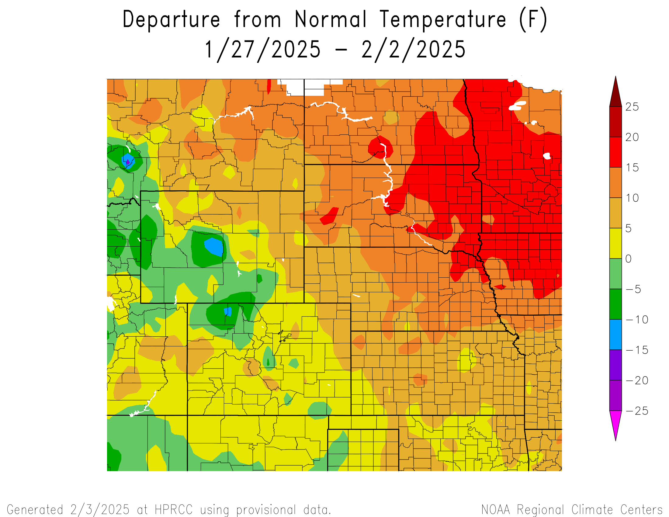
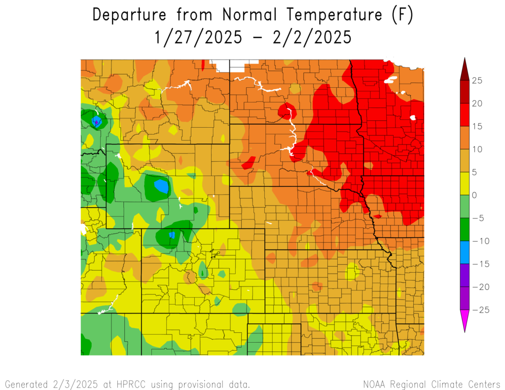
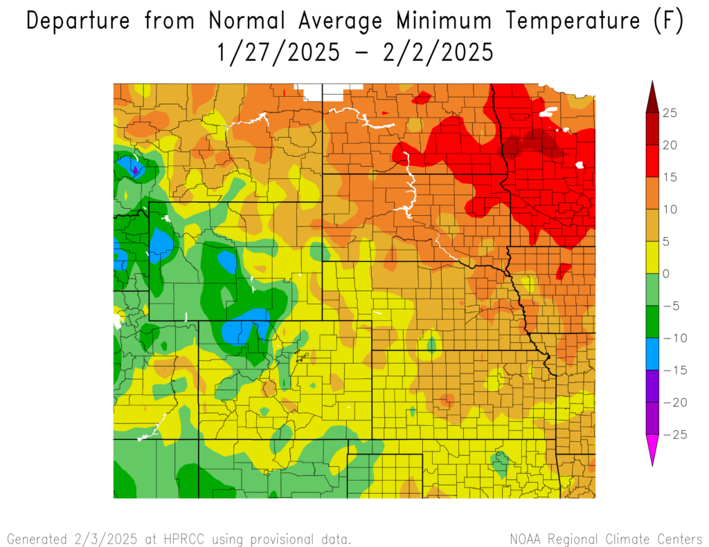
Temperatures varied in the region, with the northeastern part reaching above normal temperatures and the southwestern part reaching below normal temperatures. The warmest temperatures were in southern and eastern North Dakota, central and eastern South Dakota, and northeastern Nebraska reaching 15°F to 20°F above normal. Temperatures in central Wyoming and northwestern Colorado reached 10°F to 15°F below normal.
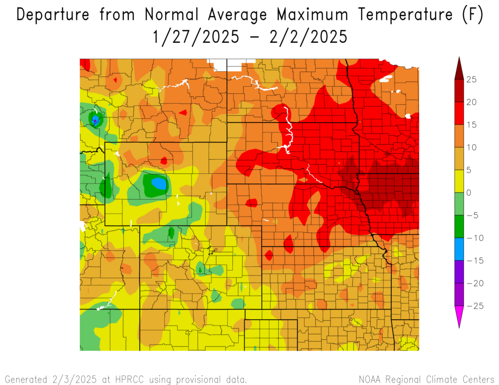
The warmest temperatures were in southeastern South Dakota and northeastern Nebraska reaching 20°F to 25°F above normal. The hottest temperature was 60°F at Medicine Lodge, Kansas which is 13°F above normal for the area. Temperatures in central Wyoming reached 10°F to 15°F below normal.
The coolest temperatures were in northwestern Colorado and central and western Wyoming reaching 10°F to 15°F below normal. The coldest temperature was -18°F at Darwin Ranch, Wyoming near Bacon Ridge, Wyoming which is 13°F below normal for the area. Temperatures in northeastern South Dakota and central and eastern North Dakota reached 15°F to 20°F above normal.
Precipitation
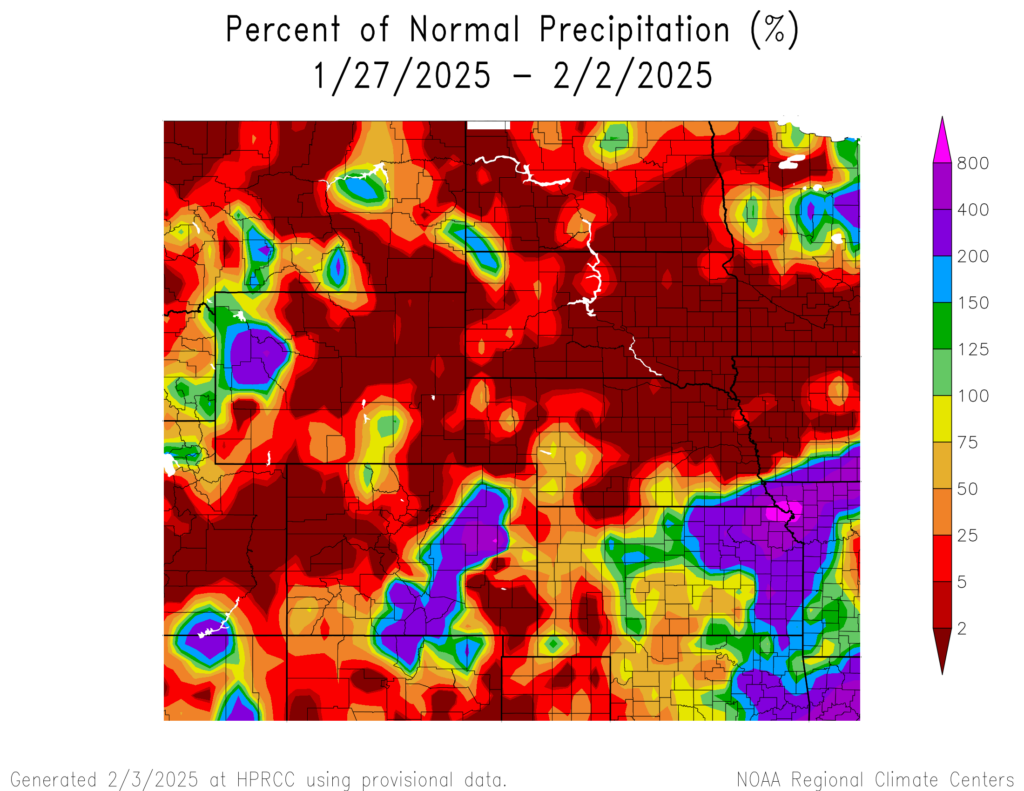
Precipitation amounts varied this week, ranging from 2 percent of normal in northwestern and the southeastern corner of Colorado, central and eastern Wyoming, central and southern North Dakota, a majority of South Dakota, northern and central Nebraska, and southwestern Kansas to 800 percent of normal in northeastern Kansas. Horton, Kansas received 1.7 inches of precipitation, well above their normal 0.03 inches; almost all of it fell on the 31st. Drought continues in the region. D0 (abnormally dry) conditions increased from 75 percent to 77 percent. In the region, Colorado experienced the highest increase in D0 conditions by 10 percent while Wyoming experienced the highest decrease in D0 conditions by 1 percent.