Regional Significant Events for September – November 2024
Highlights for the Basin
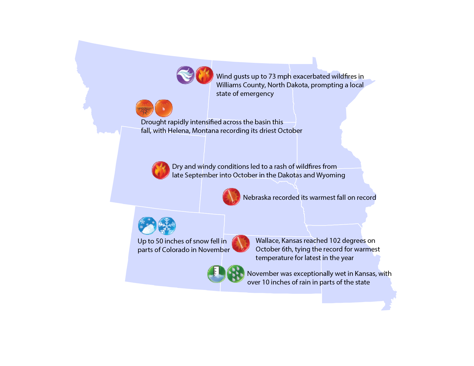
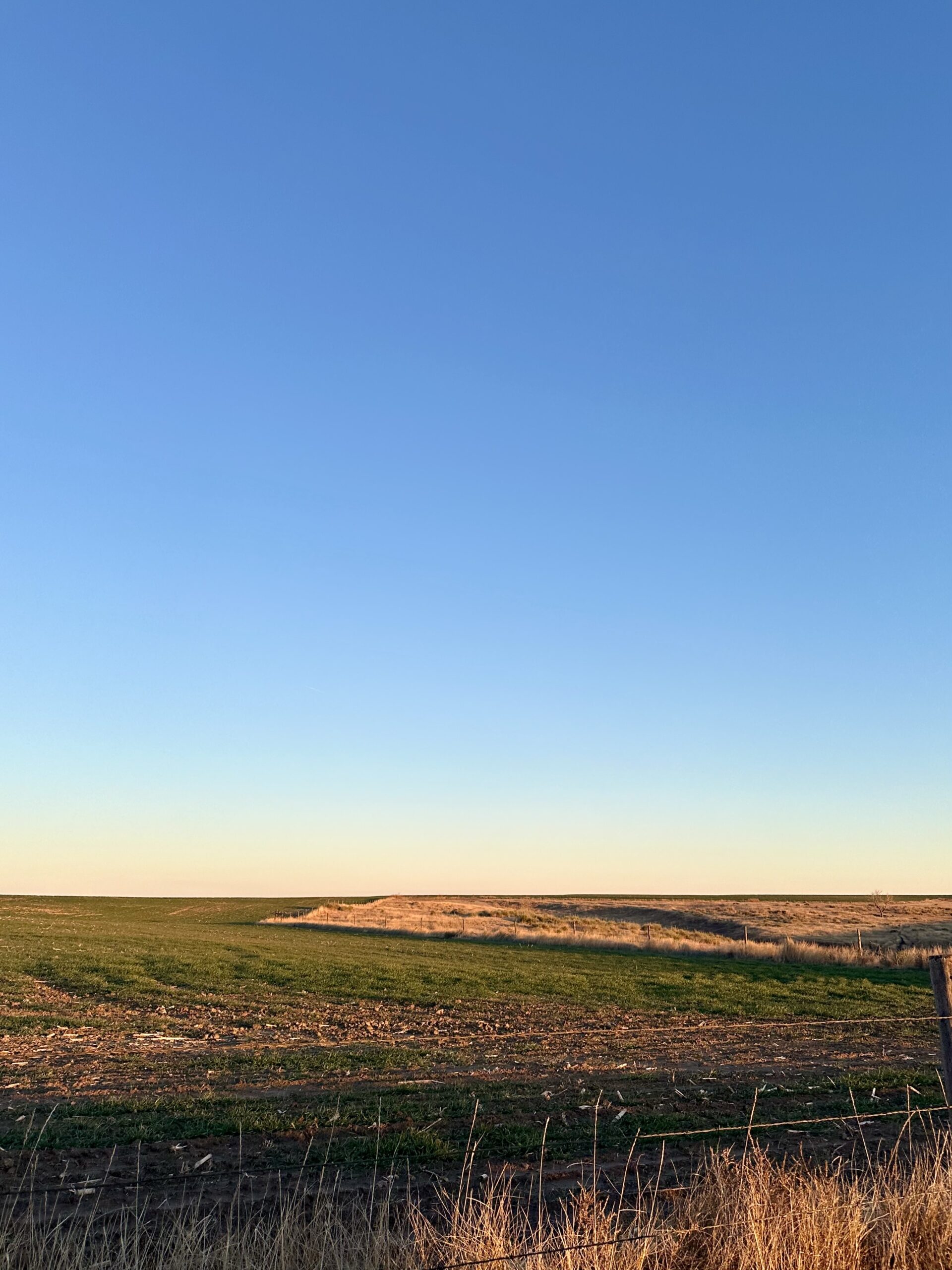
Record heat and dryness plagued the region through September and October. This two-month period was the record warmest in Colorado, Montana, South Dakota, and Wyoming, and 2nd warmest for Nebraska and North Dakota. Despite some precipitation at the very end of October, Nebraska and South Dakota also experienced the top 5 driest September and October on record.
Hundreds of wild and field fires burned nearly 300,000 acres in the Basin. A
lightning strike in Bighorn National Forest near Sheridan, Wyoming on
September 27th led to nearly 100,000 acres burned. The fire expanded over
10,000 acres on 3 separate days due to windy conditions. North Dakota reported a total of 190 fires and 126,000 acres burned in October.
Regional Climate Overview for September – November 2024
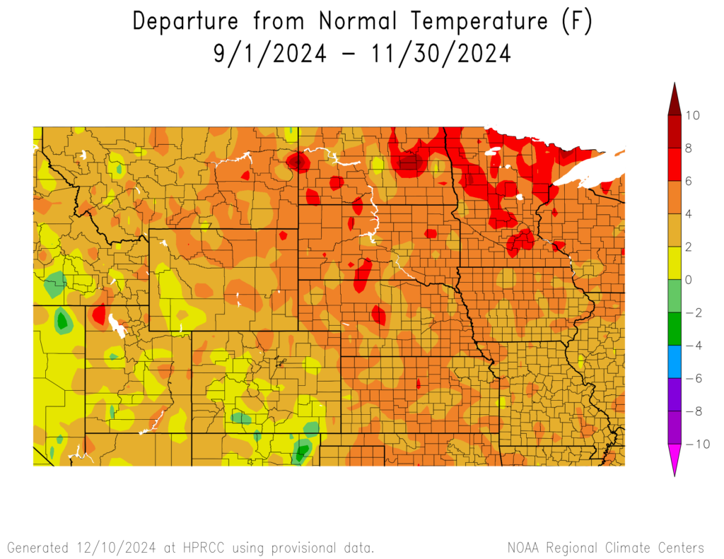
Temperature and Precipitation Anomalies
This fall was exceptionally hot across the basin, ranking the 2nd warmest on
record. September and October were historically warm, with 151 counties
recording their warmest two-month period. The west was slightly cooler in
November, however, but the eastern parts of the basin remained fairly warm. A total of 69 counties recorded their warmest fall, 33 of which were in Nebraska.
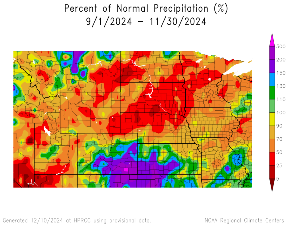
Overall, precipitation was well below normal for the Basin except for parts of
Kansas. Outside of isolated pockets in September and October, the region did
not experience widespread precipitation until November. Over 30 counties in
Nebraska and the Dakotas recorded their driest September-October, while 16
counties in Kansas recorded their wettest November on record.
and Percent of Normal Precipitation (bottom) for the Fall of 2024
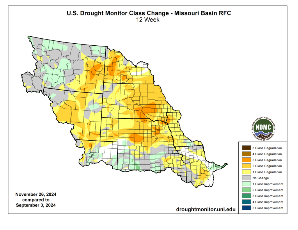
Changes in Drought Conditions
The map above shows the areas of increasing (yellow shading) and
decreasing (green shading) categories of drought. Conditions this fall
deteriorated rapidly due to the dryness and warmer temperatures,
with up to four classes of degradation in Nebraska. Extreme drought (D3)
expanded by over 11 percent this fall.
September 3 to November 26, 2024
Regional Impacts for September – November 2024
Agriculture
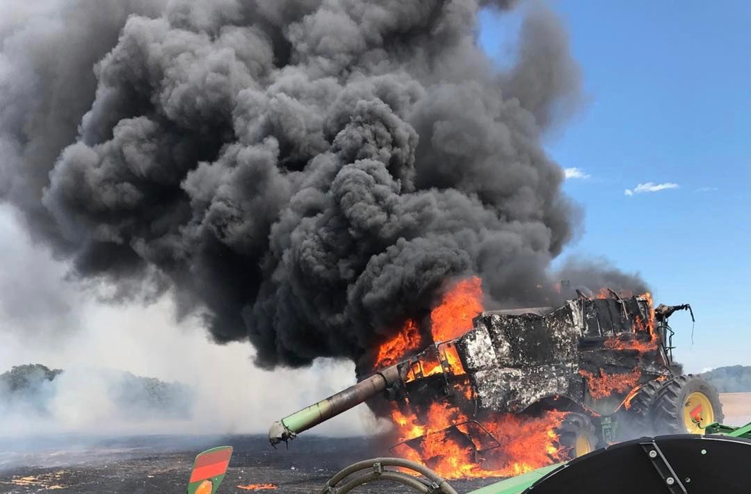
Harvest was completed early, up to weeks in advance, with shortages
of train cars around Halloween to haul grain due to its speed. Harvest
and combine fires occurred across the region, with farmers in parts of
Nebraska and South Dakota asked to stop harvesting for several days due
to the elevated fire risk. Corn yields in Nebraska and South Dakota could tie
record highs this year.
Economy
Conditions this fall were optimal for agrotourism, with great turnouts
reported at pumpkin patches and corn mazes. The warmth and dryness
were less than optimal for hunting conditions, most notably delaying
waterfowl migration. Elk habitats in Wyoming were destroyed by wildfires,
leading to a subpar hunting season. The drought and fires led to one of
the largest cattle sales in a decade in Torrington, Wyoming.
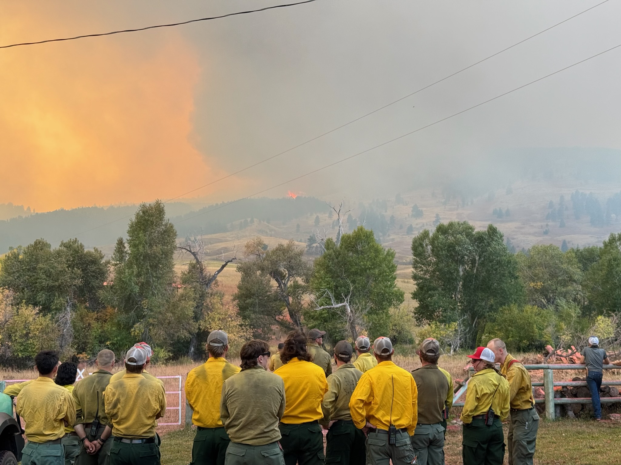
Wildfires
Hundreds of thousands of acres were burned by wildfires this fall,
predominantly in the northern part of the basin. The Elk Fire in Wyoming
closed numerous roads and led to multiple evacuations, with smoke
visible across Sheridan County for nearly a month. Numerous fires in
North Dakota during October led to two deaths and over seven million
dollars in damage.
Regional Outlook for January – March 2025
According to NOAA’s Climate Prediction Center, the outlook for the upcoming season follows a typical La Niña pattern with increased chances of below-normal temperatures across the Dakotas, Montana, Nebraska, and
Wyoming. Increased chances of above-normal precipitation are possible in
Montana and Wyoming, while below-normal precipitation is slightly favored
in southern Colorado and southwestern Kansas. The rest of the basin has
equal chances of above, below, and near-normal precipitation.
As of December 16th, there is a 59 percent chance of La Niña developing
this winter. Conditions will not last for long, with a quick shift to ENSOneutral
possible in the spring.
Temperature
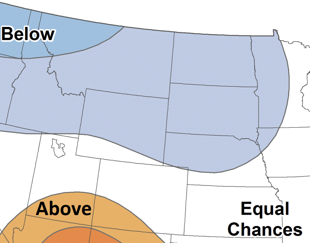
A: Above normal, B: Below normal
Precipitation
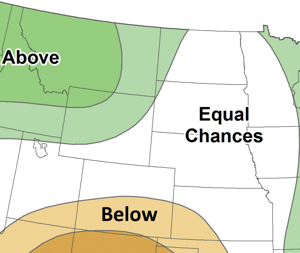
A: Above normal, B: Below normal
MO River Basin Partners
High Plains Regional Climate Center
www.hprcc.unl.edu
National Drought Mitigation Center
http://drought.unl.edu/
National Integrated Drought Information System
https://www.drought.gov/
NOAA NCEI
www.ncdc.noaa.gov
NOAA NWS – Central Region
www.weather.gov/crh
NOAA NWS Climate Prediction Center
www.cpc.ncep.noaa.gov
NOAA NWS Missouri Basin River Forecast Center
www.weather.gov/mbrfc
American Association of State Climatologists
https://www.stateclimate.org/
U.S. Army Corps of Engineers
www.nwd-mr.usace.army.mil/rcc/
U.S. Bureau of Reclamation
https://www.usbr.gov/
USDA Natural Resources Conservation Service
www.nrcs.usda.gov
USDA Northern Plains Climate Hub
www.climatehubs.oce.usda.gov
Bureau of Indian Affairs – Great Plains Region
www.bia.gov/regional-offices/great-plains
Download PDF below