Temperature
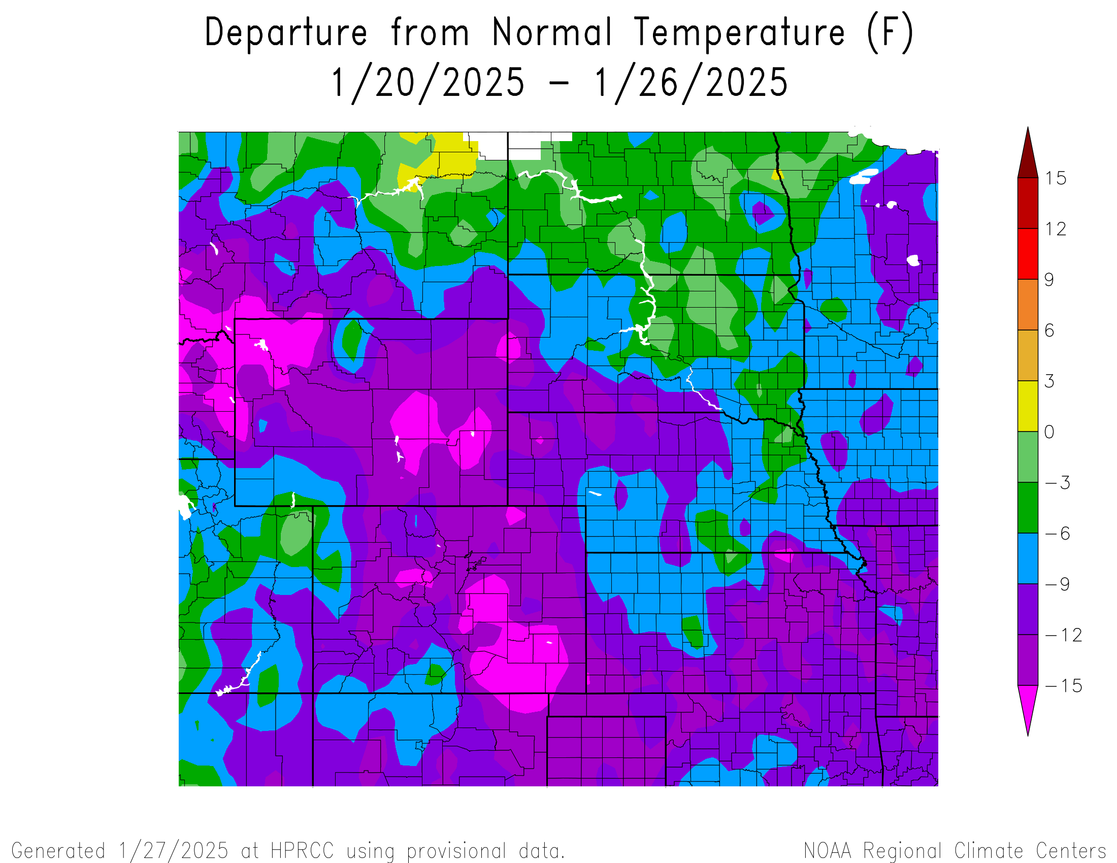
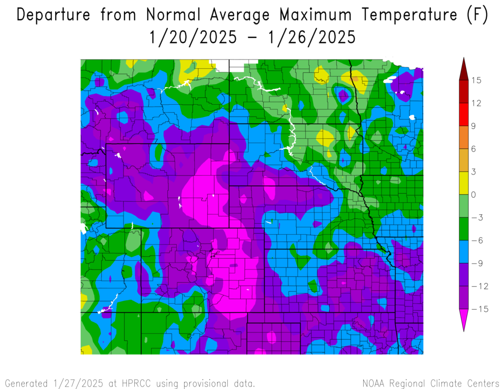
Temperatures were below normal for the region. The warmest temperatures were in central eastern North Dakota reaching 0°F to 3°F above normal. Temperatures in northwestern and eastern Wyoming, central and southeastern Colorado, central western South Dakota, and scattered parts of Nebraska and Kansas reached 16°F below normal.
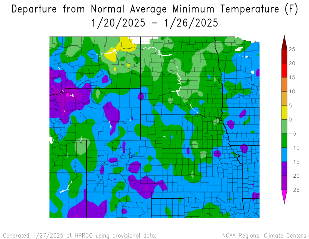
The warmest temperatures were in eastern North Dakota and northeastern South Dakota reaching temperatures 0°F to 3°F above normal. The warmest temperature was 39°F in Cortez, Colorado which is 3°F below normal for the area, and in Medicine Lodge, Kansas which is 8°F below normal for the area. Temperatures in eastern Wyoming, eastern Colorado, the panhandle of Nebraska, and western South Dakota reached 16°F below normal.
The coolest temperatures were in northwestern Wyoming and southeastern Colorado reaching temperatures 20°F to 25°F below normal, with a spot in northwestern Wyoming reaching 26°F below normal. The coldest temperature was -24°F at Darwin Ranch, Wyoming near Bacon Ridge, Wyoming which is 18°F below normal for the area. Temperatures across North Dakota, northcentral South Dakota, and scattered parts of Wyoming, Colorado, Kansas, and Nebraska reached 0°F to 5°F below normal.

Precipitation
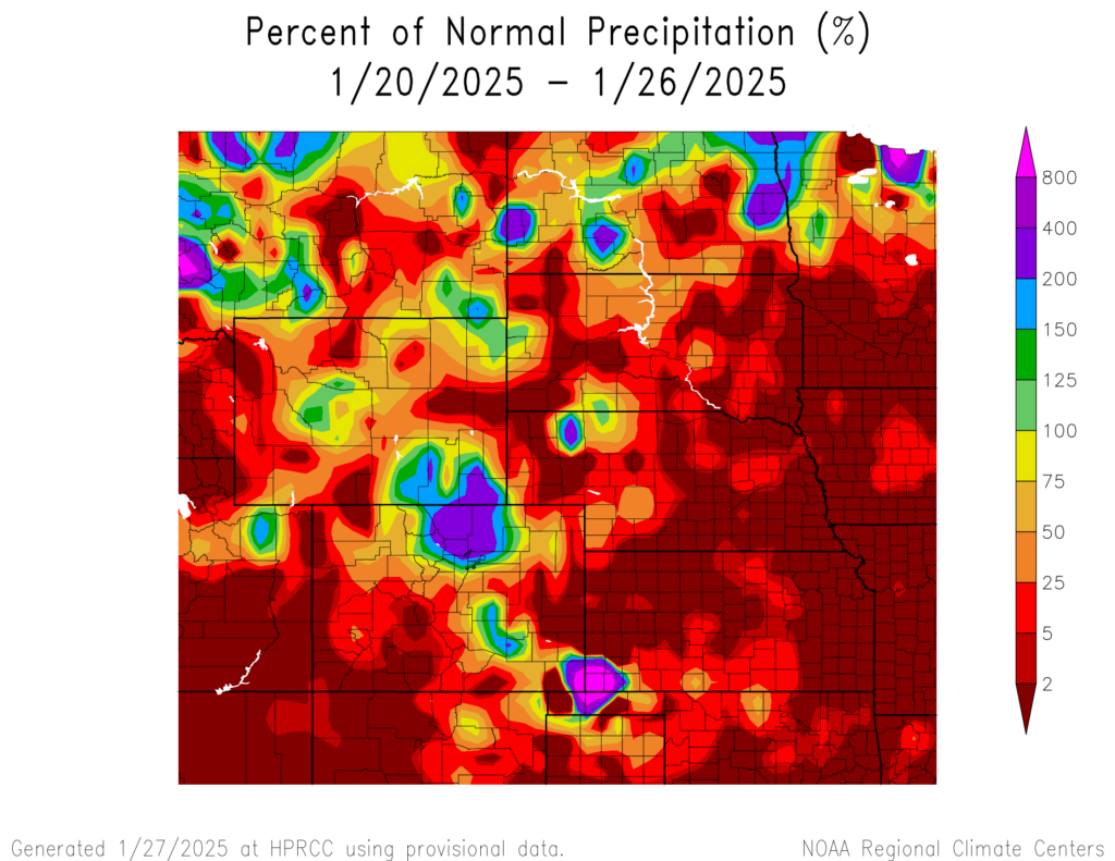
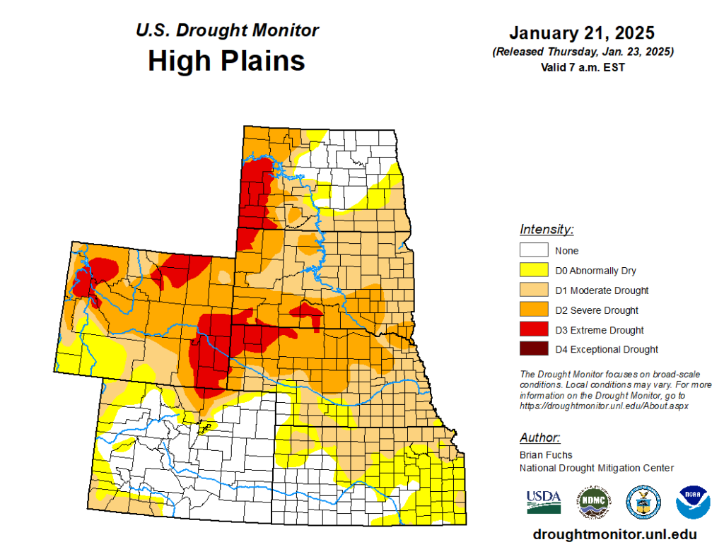
Precipitation amounts varied this week, ranging from 2 percent in southwestern Colorado, scattered parts of Wyoming, most of Kansas, most of Nebraska, and scattered parts of North and South Dakota to 800 percent of normal in the southwestern corner of Kansas and southeastern corner of Colorado. Richfield, Kansas received 2.5 inches of precipitation, well above their normal average of 0.01 inches; it all fell on the 21st. Drought continues in the region. D0 (abnormally dry) conditions remained the same as the previous week at 75 percent with no change in the drought conditions of each state either.