September 2024 Climate Summary
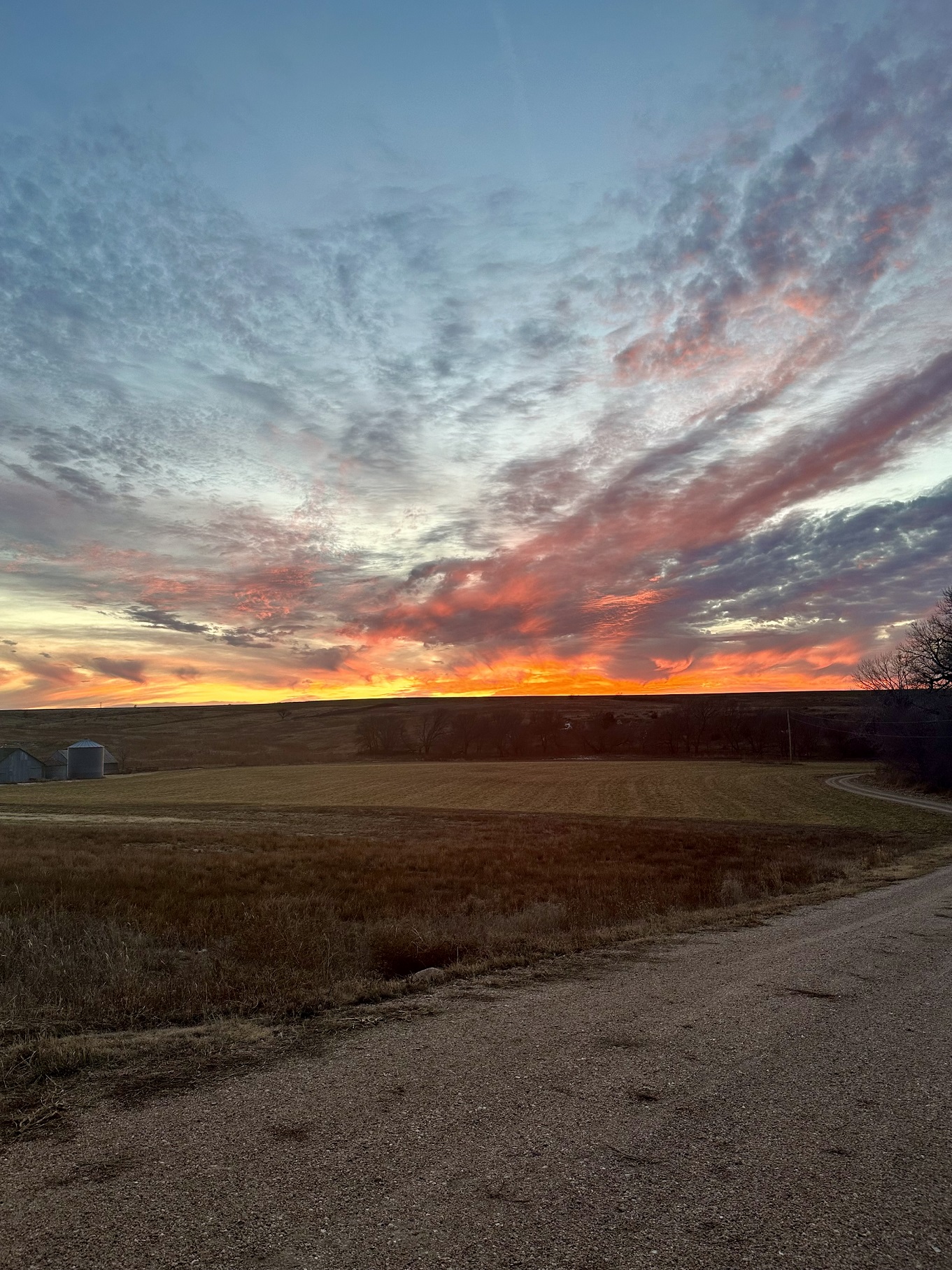
Storm over Lincoln, Nebraska, Photo Courtesy of Gannon Rush
Regional Breakdown
September was a significant step in the wrong direction for the High Plains. Record-breaking heat and dryness plagued the region, with drought concerns amplified heading into the fall months. Conditions also became conducive to wildfires as the month progressed, with several small fires breaking out across the Dakotas.
The warmth early in the year and the recent heat have led to an early harvest across the High Plains. The corn and soybean harvests are ahead of schedule in nearly every state, with near-record corn yields projected in Nebraska. Despite lower rainfall in the previous months, record to near-record yields are expected in Nebraska. On the flip side, those planting winter wheat must make the choice of either planting in dry soils or wait and hope for moisture in the near future. Topsoil moisture conditions that were rated as short to very short in Kansas and South Dakota were above 55 percent, while subsoil moisture was equally poor.


Precipitation and Water Resources
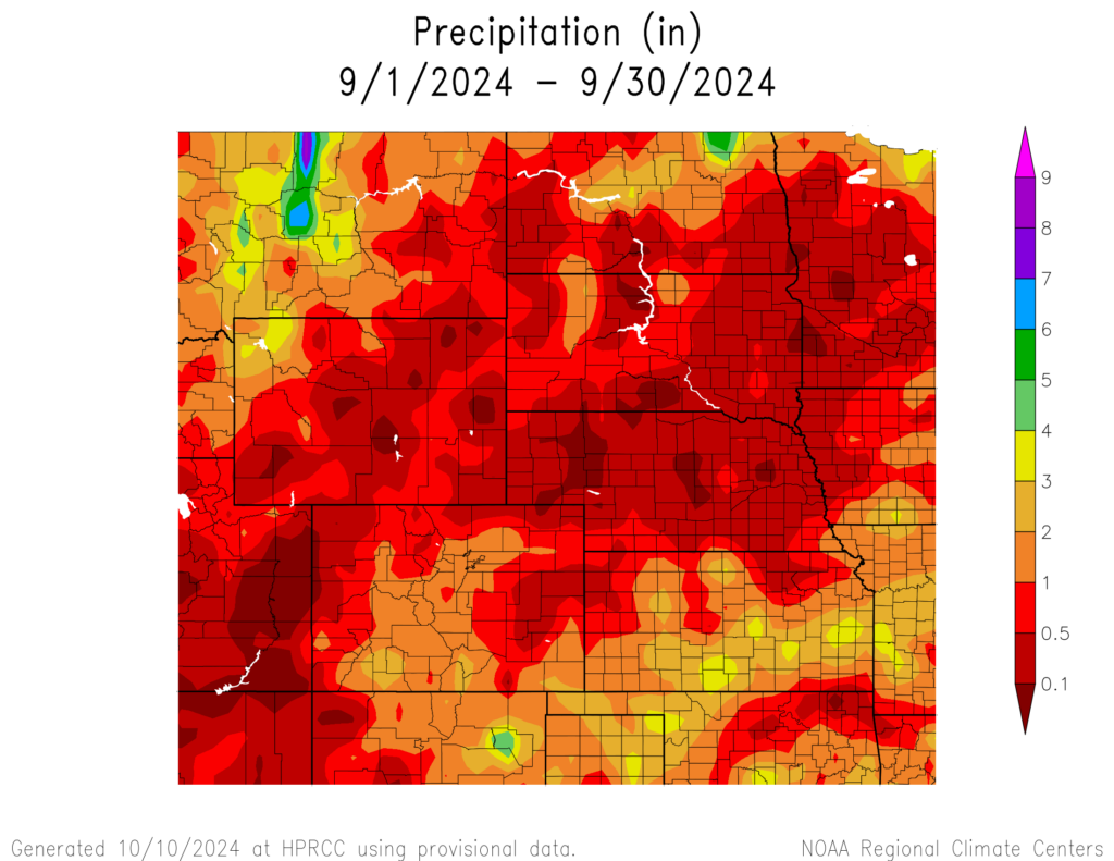
Large swathes of the High Plains received less than an inch (25.4 mm) of precipitation this month, with only a few places in the region reporting above-normal precipitation. The lack of rain led to at least one prominent location in every state to record their driest month.
Nebraska was the driest, with 21 stations recording their driest September. Norfolk only observed a mere 0.03 inches (0.76 mm) of precipitation this month, beating their previous record by 0.23 inches (5.84 mm). Nearby Omaha also ranked driest, with only 0.09 inches (2.29 mm) falling. Elsewhere in the state, Chadron, Grand Island, Hastings, Lincoln, and Valentine ranked in the top 5 driest. Outside of a few pockets, the state has not seen widespread rainfall in several months.
The Dakotas were also exceptionally dry this month, with only a few locations in both states observing meaningful rainfall. In South Dakota, Sioux Falls and Mobridge received less than 0.05 inches (1.27 mm) to rank driest. Sisseton and Huron also ranked in the top 5. Up in North Dakota, Fargo ranked driest with only 0.08 inches (2.03 mm)
Wyoming has been extraordinarily dry this year, with parts of the state below 5 inches (12.7 cm) of rain through the end of September. Big Piney in the western part of the state has only recorded 3.32 inches (8.43 cm), with most of it falling in the first half of the year. Combined with the warm temperatures this summer, drought has significantly intensified in Wyoming.
Streamflow at the end of September was above normal across eastern portions of the Dakotas. On the other hand, streamflow was much below normal to record lows in Colorado, Kansas, and Nebraska.


Temperatures
September was scorching hot across the region, with some areas 10 degrees F (5.6 degrees C) above normal. Monthly records were shattered by up to 3 degrees F (1.7 degrees C) in the Dakotas, while every state had a location rank in the top 5 warmest.
Every major location and 19 locations in total in North Dakota recorded their warmest September on record, with several remarkable records coming from the state. Grand Forks recorded an average temperature of 67 degrees F (19.4 degrees C) this month, beating the previous record by 2.8 degrees F (1.6 degrees C). Just to the south, Fargo narrowly missed the statewide average temperature record for September. The town of Hettinger in southwestern North Dakota set the statewide average maximum temperature, with an average high of 86 degrees F (30 degrees C) this month.
South Dakota broke numerous records this month as well, with 22 locations recording their warmest September. Mobridge broke its record this month by 3.3 degrees F (1.8 degrees C), with an average temperature of 70.8 degrees F (21.6 degrees C). Sisseton and Rapid City also broke their records, while Aberdeen, Huron, and Sioux Falls ranked in the top 5 warmest.
Elsewhere in the region, several other major locations observed record warmth. Denver, Colorado narrowly broke their record, with an average temperature of 70 degrees F (21.1 degrees C). To the north, the town of Sheridan in Wyoming surpassed their record. While in Nebraska, towns in the west such as Chadron, Scottsbluff, and Valentine experienced record warmth this month.
Drought Conditions
The heat and dryness this month led to the widespread introduction and intensification of drought in the High Plains. Wyoming was hit the hardest this month, while the western portions of the Dakotas were also taking a significant step backward. Overall, the region observed an increase of 13 percent in abnormally dry to exceptional drought conditions (D0 to D4).
Wyoming, and particularly the eastern part of the state, has experienced below-normal precipitation for nearly a year. Extreme drought (D3) rapidly expanded this month, with 12 percent of the state encompassed at the end of the month. At the beginning of October, nearly 97 percent of the state is in D0 to D4.
Nebraska missed nearly all the rain this month, and drought conditions expanded across the state as a result. Several different areas within Nebraska experienced a two-class degradation from the dryness. Moderate drought to exceptional drought (D1 to D4) increased by nearly 21 percent in September and covers close to 50 percent of the state.
Elsewhere in the region, other improvements and degradation were observed. According to the Climate Prediction Center’s U.S. Monthly Drought Outlook for October, drought conditions will expand in Kansas, Nebraska, and South Dakota.


Department of Agriculture (USDA), National Drought Mitigation
Center, U.S. Department of Commerce, and the National Oceanic and
Atmospheric Administration (NOAA). For current Drought Monitor
information, please see: http://droughtmonitor.unl.edu/
Climate Outlooks
According to the Climate Prediction Center, ENSO-neutral conditions are present. A La Niña watch is currently in effect. For more information, visit https://www.cpc.ncep.noaa.gov/products/analysis_monitoring/lanina/enso_evolution-status-fcsts-web.pdf
The National Weather Service’s long-range flood outlook indicates low chances of Minor Flooding along the Missouri River through December. According to the National Interagency Fire Center (NIFC), fire potential will be elevated in Wyoming and South Dakota in October.
The seasonal temperature and precipitation outlook presented below combine the effects of long-term trends, soil moisture, and when applicable, the El Niño Southern Oscillation (ENSO). To learn more about these outlooks, please visit http://www.cpc.ncep.noaa.gov.
Temperature
The three-month temperature outlook shows an increased chance of above-normal temperatures across the much of the United States. Above-normal temperatures are possible across most of the High Plains, except for the Dakotas.

Precipitation
The outlook for the next three months indicates below-normal precipitation across the south-central United States, while above-normal is possible in the northwest and northeast. Below-normal precipitation is possible in Colorado and Kansas.

Drought
The U.S Seasonal Drought Outlook released on September 30th indicates that drought development and expansion is likely in Kansas, Nebraska, and South Dakota.

Station Summaries: By the Number


Download PDF Below


