Temperature
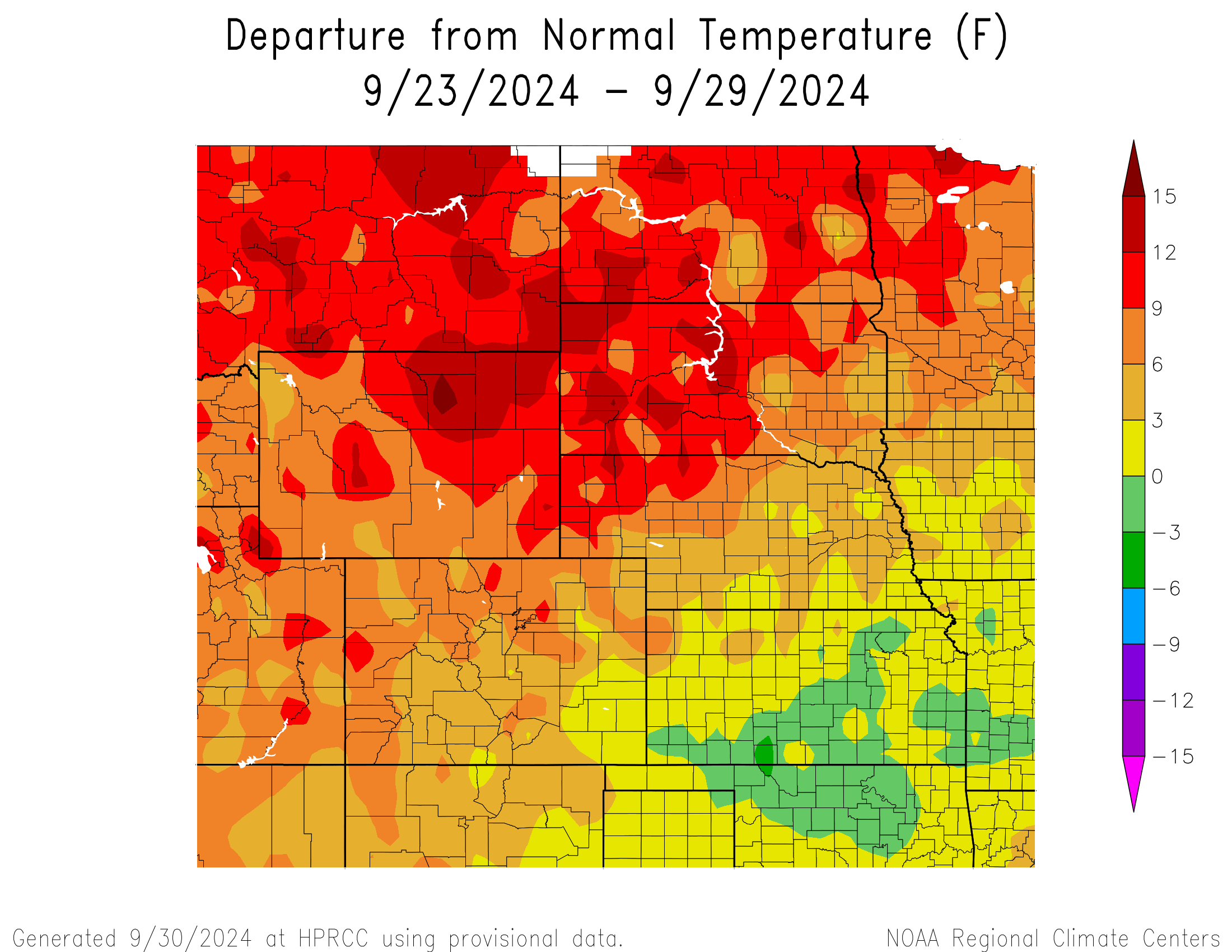
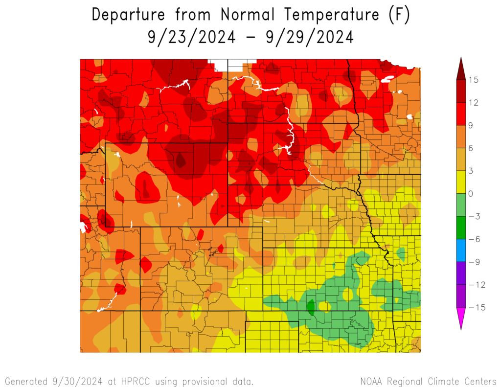
This week featured above normal temperatures for a majority of the region. The warmest regions were northeastern Wyoming, the Nebraska panhandle, central and western South Dakota and most of North Dakota reaching temperatures 9°F to 12°F above normal with some areas reaching 12°F to 16°F above normal. The coldest region was central and southern Kansas reaching 0°F to 3°F below normal with a spot in southcentral Kansas reaching 3°F to 6°F below normal.
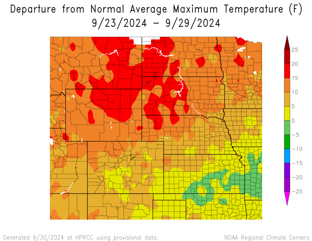
This week featured above normal temperatures for most of the region. The warmest regions were western North Dakota, western South Dakota, northern Wyoming, and northern parts of the Nebraskan panhandle reaching temperatures 15°F to 20°F above normal. The warmest temperature was 92°F in Sheridan, Wyoming which is 21°F above normal for the area. Temperatures in central and eastern Kansas reached temperatures 0°F to 5°F below normal.
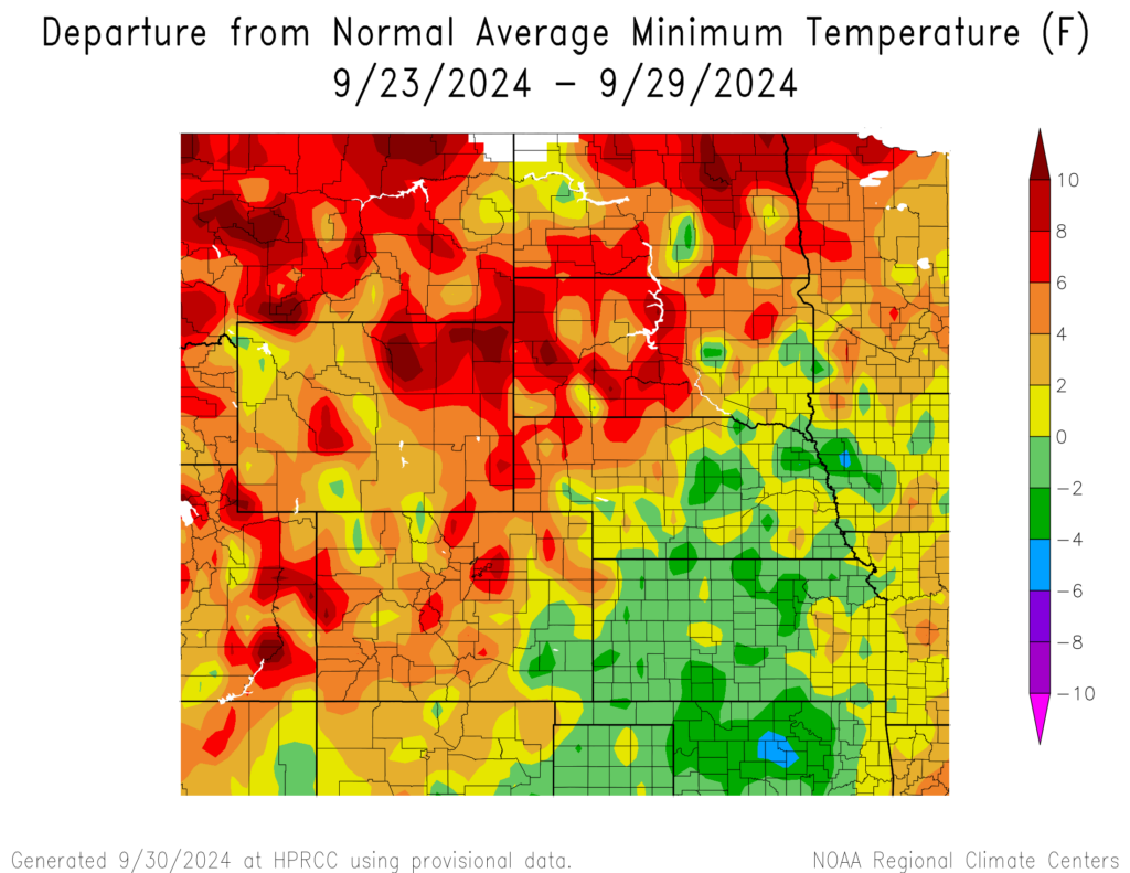
Northern North Dakota, western South Dakota, and northeastern Wyoming reached temperatures of 6°F to 8°F above normal with some spots reaching 8°F to 11°F above normal. Temperatures in central and southern Nebraska, southeastern Colorado, and a majority of Kansas reached temperatures 0°F to 2°F below normal with some areas reaching 2°F to 4°F below normal. The coldest temperature was 37°F in Leadville, Colorado which is 2°F below normal for the area.
Precipitation
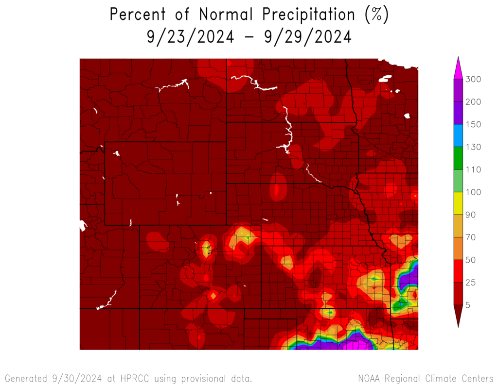
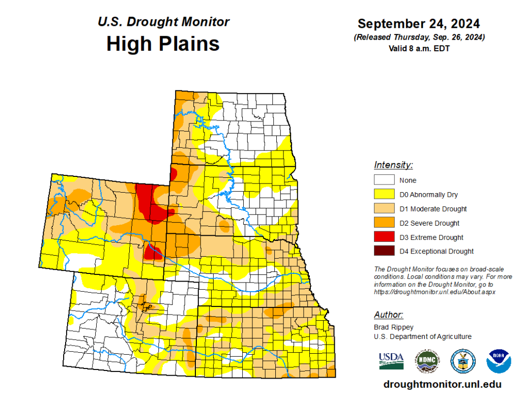
A majority of the region received 2% of normal precipitation. Parts of central and northeastern Colorado and central and eastern Kansas received 100-130% of normal precipitation. Haysville, Kansas received 2.03 inches of precipitation; most of this fell on the 23rd. Drought continues in the region. D0 (abnormally dry) conditions increased from 68% to 71%. In the region, Kansas experienced the highest decrease in D0 conditions by 5% while North Dakota experienced the highest increase in D0 conditions by 44%.