March 2024 Climate Summary
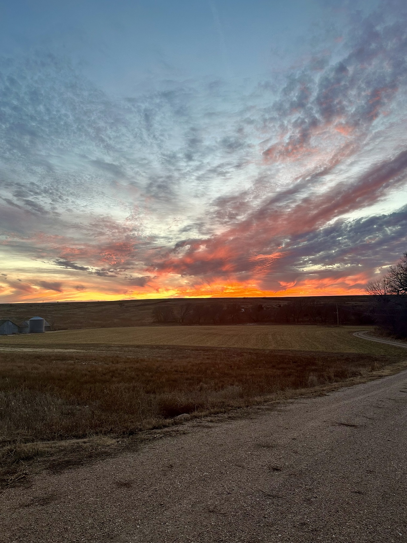
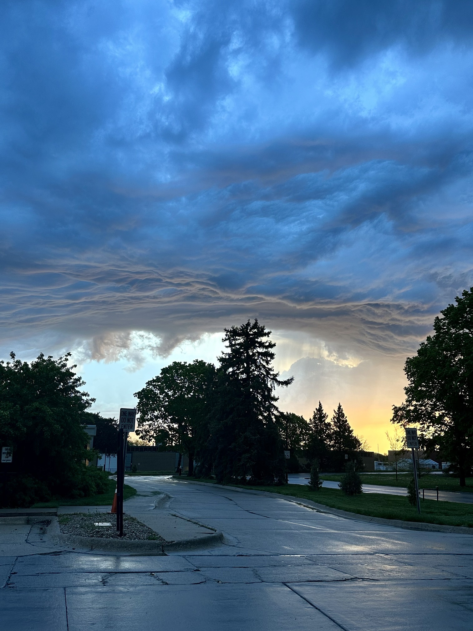
Stormy Sunrise over Lincoln, Nebraska, Photo Courtesy of Gannon Rush
Regional Breakdown
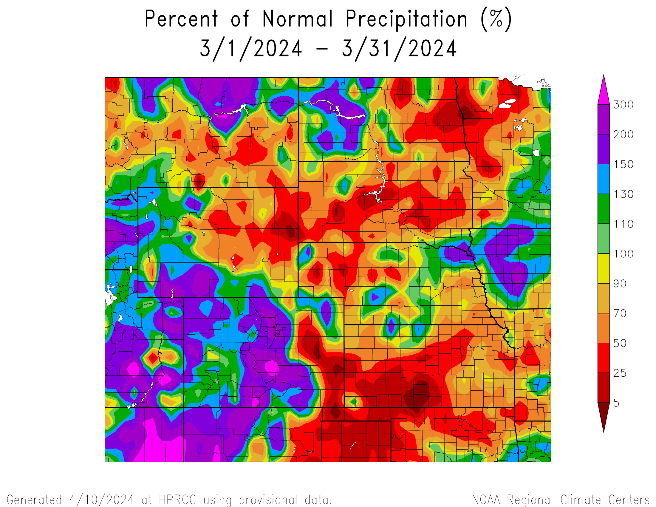
A late winter storm impacted the region at the end of March, bringing blizzard conditions and severe weather. Despite the significant storm, much of the region received below normal precipitation this month.
In a typical display of the unpredictability and whiplash of the plains, parts of western Kansas were under both tornado and blizzard warnings at the same time. Several tornadoes touched down, followed by up to 6 inches (15.24 cm) of snow and wind gusts of 40 mph (64 km/h). A brief EF-1 tornado with 90 mph (145 km/h) winds hit the town of Garden City, causing minor damage.
The winter weather associated with the system wreaked havoc in nearly every state in the region. Major interstates were closed, with poor road conditions stretching from Kansas to North Dakota. The hardest hit states were Colorado and South Dakota, with reports of up to 12 inches (30.48 cm) of snow. Strong winds led to whiteout conditions, leading to a rash of wrecks.

Precipitation and Water Resources
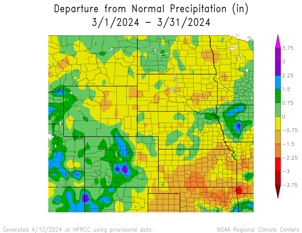
Precipitation was spotty throughout the region except for Colorado. Parts of the state experienced record wetness, while parts of south-central Kansas reported trace to no precipitation.
Much of the precipitation in Colorado this month was snow, falling from a significant storm in the middle of the month. Highways were closed across the state and over 800 flights were canceled at Denver International Airport. The snow was extremely heavy, leading to branches breaking and causing scattered power outages. Over 60 inches (152.4 cm) fell in parts of the Rockies, while portions of the foothills received over 12 inches (30.48 cm) this month. Canon City and Fruita crushed their precipitation records by over an inch (2.54 cm) due to the exceptional wetness.
While much of Nebraska was dry, a record-setting snowstorm impacted North Platte early this month. In the city, 15.3 inches (38.86 cm) of snow fell on the 7th and set a new single-day record. The snow was extremely heavy at times, with up to 3 inches (7.62 cm) falling per hour. This narrow band stretched to the Broken Bow area; however, snowfall totals were much lower elsewhere.
Despite most of Colorado being wet, the eastern plains were very dry. Minimal amounts of precipitation were reported around Campo and Lamar, with some areas receiving less than 0.10 inches (2.54 mm). Just across the border in Kansas, areas between Dodge City and Wichita received similar amounts resulting in drought expansion.
At the end of March, snowpack is in great shape across Colorado and southern Wyoming. Across northern Wyoming and Montana, Snow Water Equivalent (SWE) remained at exceptionally low levels. Streamflow was in the 10th percentile in eastern Nebraska and northern Kansas, while the heavy precipitation in Colorado led some gauges to be at near-record highs.

Temperatures
March brought cooler temperatures for parts of the west, while the eastern portions of the region remained warm. The system that pushed through the region in late March led to a cool-down for many.
While temperatures for the month were on both ends of the spectrum, nothing was out of the ordinary. The only major location to rank in the top 10 warmest or coldest was Laramie, Wyoming. The city ranked as the 8th warmest with an average temperature of 35.3 degrees F (1.8 degrees C), while surrounding locations such as Cheyenne or Rawlins were just outside the top 10.
The front that pushed through late in the month provided some relief to the eastern parts of the region. While no records were broken, it did lead temperatures to drop below freezing for some and created potential issues for blooming plants.
Drought Conditions
Drought conditions within the region are in decent shape at the end of March. Expansion and intensification were sporadic, but not serious. Overall, the region observed a slight increase of less than a percent of D0 to D4 (abnormally dry to exceptional drought conditions).
The drought that has plagued central and eastern Nebraska has slowly improved over the past few months, with a pocket of D2 (severe drought) remaining between Lincoln and Grand Island. This is a significant improvement over the previous year, when D4 was present within the state.
Similar to Nebraska, Kansas is in much better shape than 2023. Although there was a slight intensification in the south-central part of the state where it was nearly bone-dry, the current situation is significantly less bleak than the previous year when D4 covered the southwestern portions of the state. Elsewhere in the region, other improvements and degradation were observed. According to the Climate Prediction Center’s U.S. Monthly Drought Outlook for April, drought conditions will improve or be removed in the southern portions of the High Plains but remain in the northern parts.


Department of Agriculture (USDA), National Drought Mitigation
Center, U.S. Department of Commerce, and the National Oceanic and
Atmospheric Administration (NOAA). For current Drought Monitor
information, please see: http://droughtmonitor.unl.edu/
Climate Outlooks
According to the Climate Prediction Center, El Niño conditions are likely to continue but transition towards ENSO-neutral in mid to late Spring. An El Niño advisory and La Niña watch is currently in effect. For more information, visit https://www.cpc.ncep.noaa.gov/products/analysis_monitoring/lanina/enso_evolution-status-fcsts-web.pdf
The National Weather Service’s long-range flood outlook indicates elevated chances of Minor and Moderate Flooding in the eastern parts of Kansas through the end of June. According to the National Interagency Fire Center (NIFC), fire potential will be elevated in South Dakota, eastern Colorado, and western Kansas in April.
The seasonal temperature and precipitation outlook presented below combine the effects of long-term trends, soil moisture, and when applicable, the El Niño Southern Oscillation (ENSO). To learn more about these outlooks, please visit http://www.cpc.ncep.noaa.gov.
Temperature
The three-month temperature outlook shows an increased chance of above-normal temperatures across the much of the United States. Above-normal temperatures are slightly favored across the majority of the region minus the Dakotas.

Precipitation
The outlook for the next three months indicates below-normal precipitation across the Pacific Northwest and the Southwest, while above-normal precipitation is favored for the southeastern United States. Below-normal precipitation is favored in western Colorado.

Drought
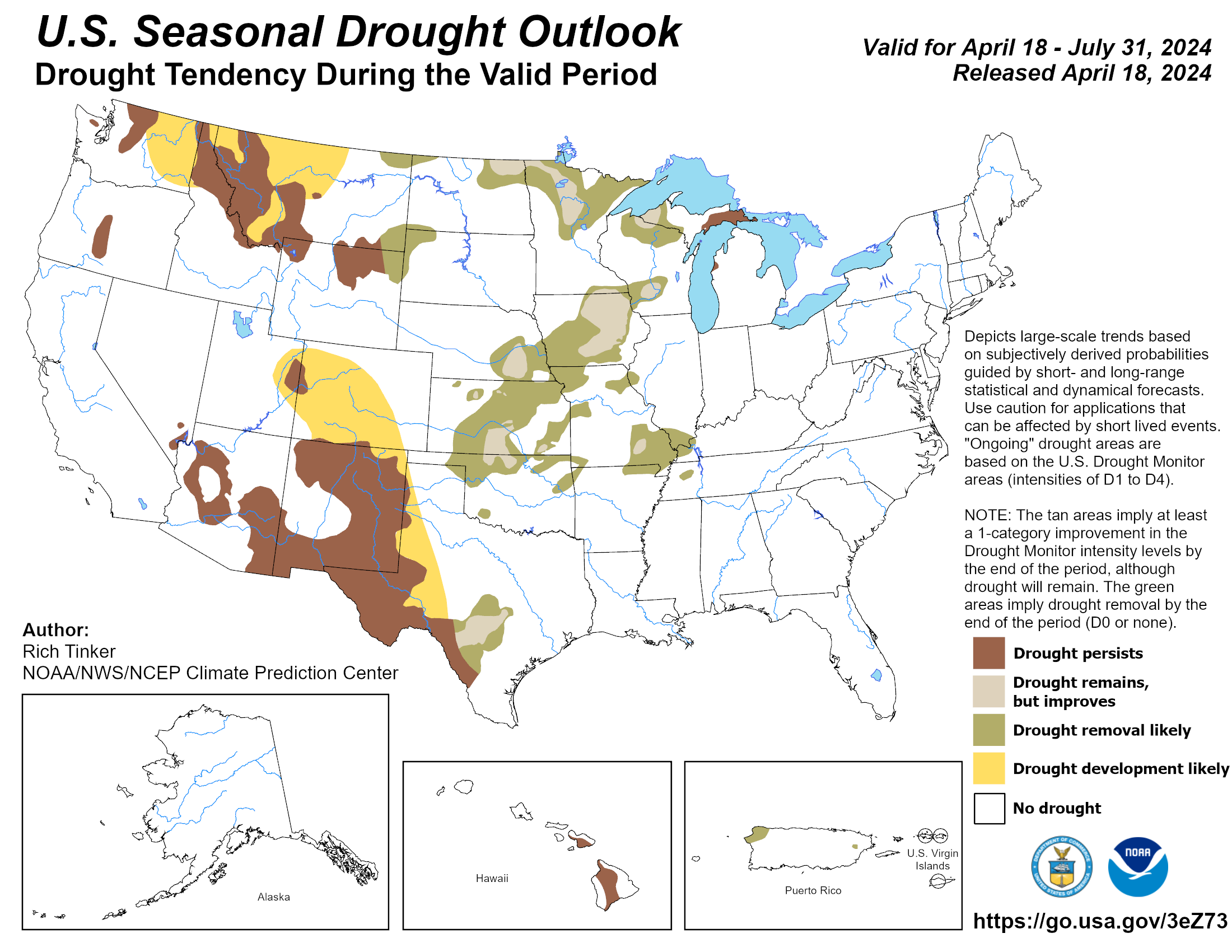
The U.S Seasonal Drought Outlook released on April 18th indicates that improvements to drought conditions will occur across the region.
Station Summaries: By the Number


Download PDF Below
