Regional Significant Events for December 2023 – February 2024
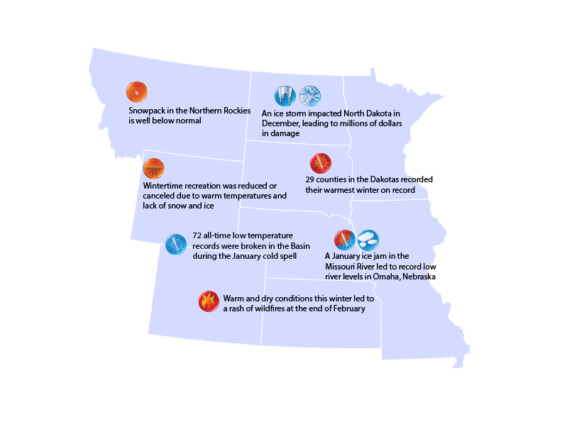
Highlights for the Basin
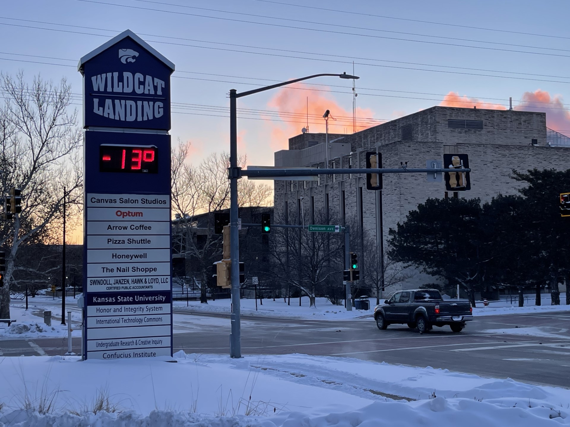
This winter was historically warm in the Dakotas, with records obliterated in
some places. 46 counties in both states broke their minimum temperature
records for the winter. Highlighting the extreme warmth, Cass and Traill in North Dakota were nearly 17 degrees F above their normal minimum temperatures. Within Cass County, Fargo surpassed their previous average temperature record by 4.4 degrees F and their average minimum temperature by 4.8 degrees.
Late February brought the return of fire weather, with a large fire breaking out
near North Platte, Nebraska. 71,000 acres burned in just a day and a disaster
was declared by the state, however, minimal damage occurred due to the
sparse population.
Regional Climate Overview for December 2023 – February 2024
Temperature and Precipitation Anomalies
In typical El Niño fashion, temperatures were well above normal for the region.
December and February brought record warmth, but January was below
normal due to the single but very cold air outbreak. North Dakota recorded its
warmest winter on record, while the majority of the region ranked in the top 5.
Precipitation was above normal for the southern and eastern parts of the basin, while the northwestern portions were below normal. December was unusually wet in the Dakotas, with 11 counties ranking wettest. Several winter storms impacted the southeastern parts of the Basin in January, while February was nearly bone-dry for eastern Nebraska and parts of the Dakotas.
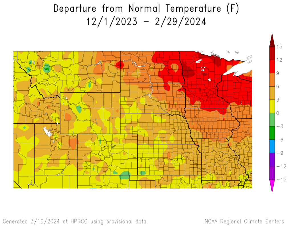
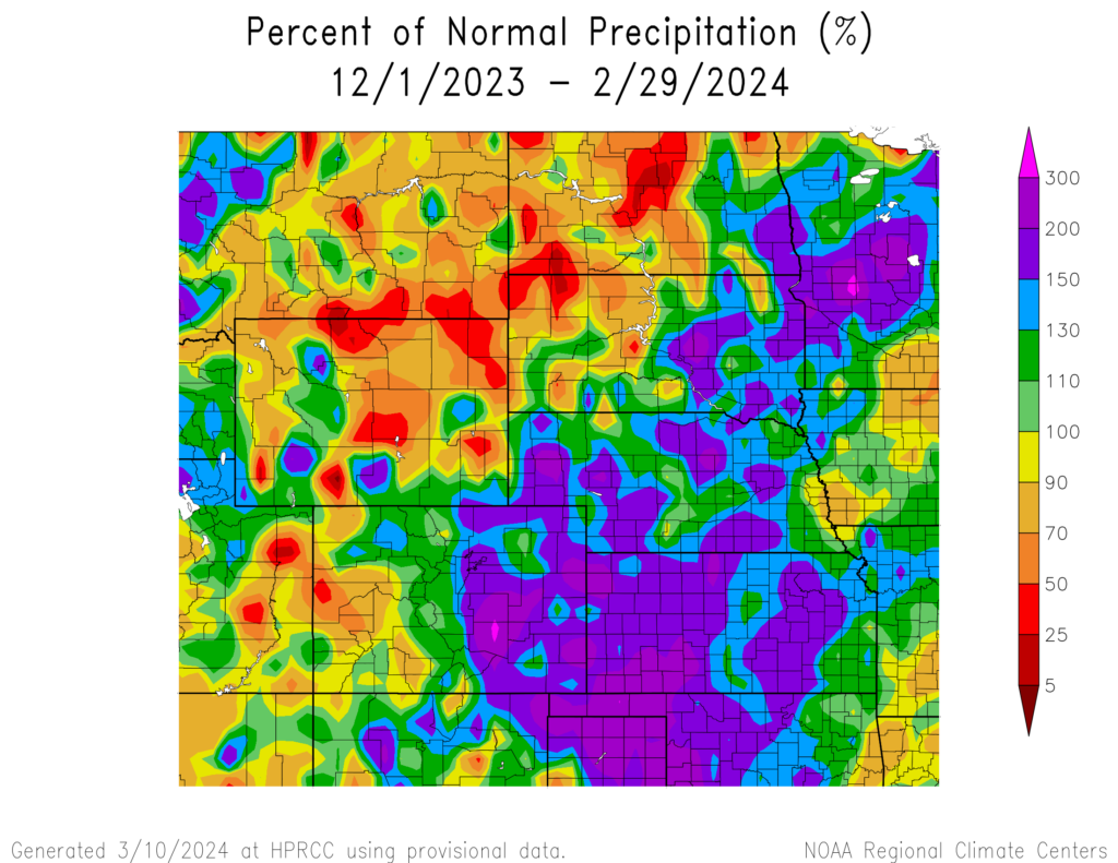
and Percent of Normal Precipitation (bottom) for the Winter of 2023-2024
Snow Drought This Winter
The map below shows the percent of normal snowfall for this winter, with
shades of red/yellow representing below normal and shades of blue/
green meaning above-normal. Typical of an El Niño pattern, snowfall was
below normal in the northern basin. Parts of northern Wyoming were 30
inches below their normal snowfall this winter.
December 1, 2023 to February 29, 2024

Regional Impacts for December 2023 – February 2024
Agriculture
Warmer temperatures led farmers to begin fieldwork much earlier than
usual, with soybeans already planted in some parts of Nebraska. Winter
wheat is also highly susceptible to frost this spring after breaking
dormancy early. Calving was easier this year due to lower snowfall and
warmer temperatures, however, these conditions have led to early
insect emergence.
Water Resources
Snowpack by mid-March was at 75 percent in the Northern Rockies. Runoff will likely be well below normal, with potential implications for irrigators and navigation this summer. Rivers in the northern portions of the Basin were ice-free at the end of February, which is several weeks ahead of a typical year. Drought conditions increased up to three classes this winter due to the dryness.
Phenology
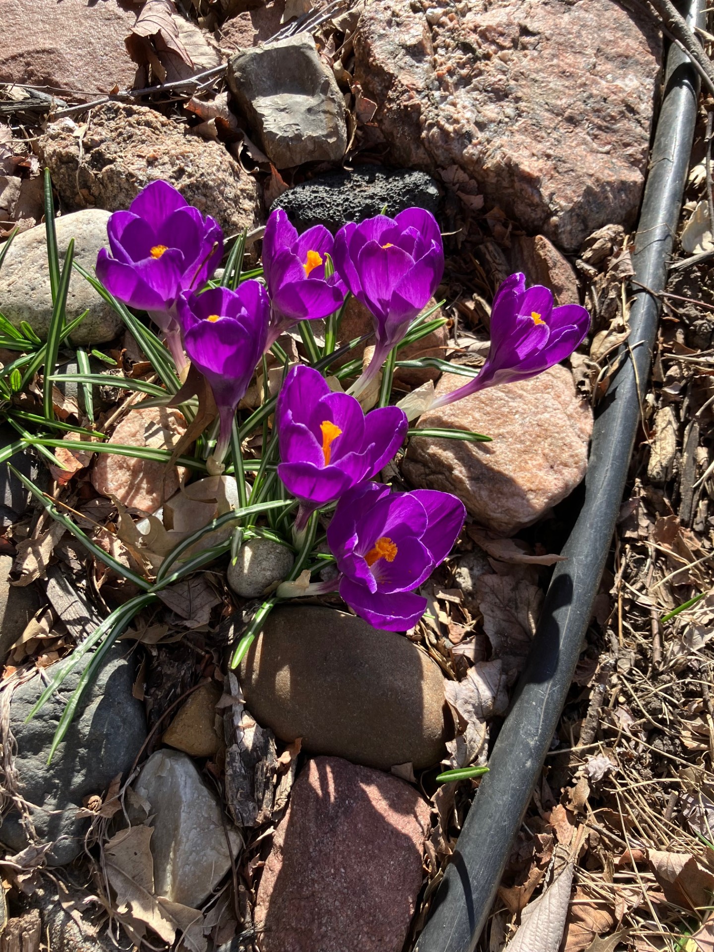
In response to the unseasonably warm temperatures, plants across
the southern part of the region began greening up weeks earlier than
usual. Spring blooming perennials were blossoming in Kansas City by
late February, which led to an earlier occurrence of seasonal allergies and
more susceptible to a late frost.
January Cold Air Outbreak
A bone-chilling cold outbreak impacted the region in the middle of January.
Combined with gusty winds, wind chills bottomed out at –70 degrees F
in North Dakota. Thousands of daily records were broken, and numerous
all-time records across the Basin. The Kansas City Chiefs playoff game ranked as the 4th coldest NFL game, with wind chills reaching –28 degrees. Helmets shattered due to the cold, and dozens of cases of frostbite were reported. 70% of frostbite cases were advised to undergo amputations.
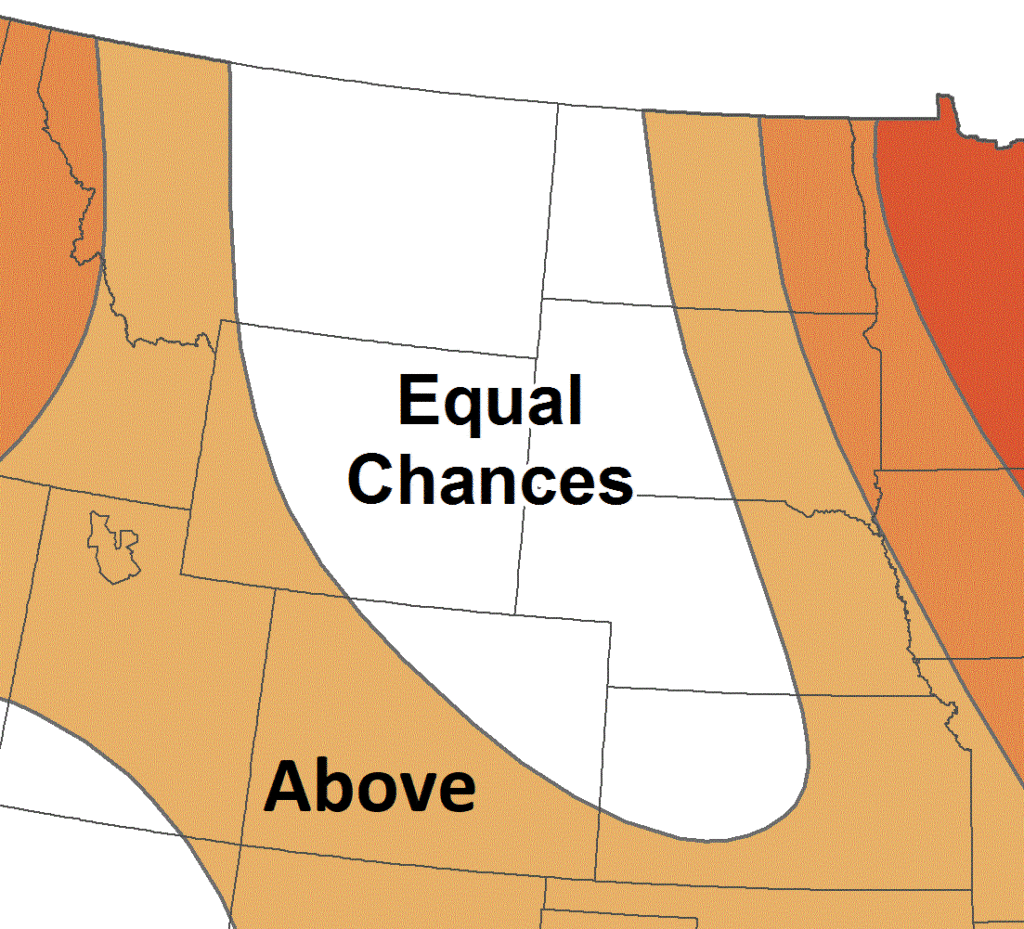
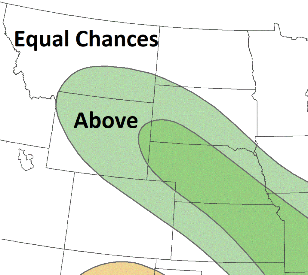
Regional Outlook for April – June 2024
According to NOAA’s Climate Prediction Center, the outlook for the upcoming season indicates increased chances of above-normal temperatures across the eastern and western portions of the Basin. Increased chances of above-normal precipitation are present in Kansas, Nebraska, South Dakota, Wyoming, and southern Montana. The rest of the Basin has equal chances of above, below, and near-normal precipitation.
El Niño influences will end and shift towards ENSO-neutral this spring. Above-normal precipitation this spring across the central portions of the Basin would be beneficial to drought conditions, however, this could lead to delays in fieldwork and planting.
Temperature
A: Above normal, B: Below normal
Precipitation
A: Above normal, B: Below normal
MO River Basin Partners
High Plains Regional Climate Center
www.hprcc.unl.edu
National Drought Mitigation Center
http://drought.unl.edu/
National Integrated Drought Information System
https://www.drought.gov/
NOAA NCEI
www.ncdc.noaa.gov
NOAA NWS – Central Region
www.weather.gov/crh
NOAA NWS Climate Prediction Center
www.cpc.ncep.noaa.gov
NOAA NWS Missouri Basin River Forecast Center
www.weather.gov/mbrfc
American Association of State Climatologists
https://www.stateclimate.org/
U.S. Army Corps of Engineers
www.nwd-mr.usace.army.mil/rcc/
U.S. Bureau of Reclamation
https://www.usbr.gov/
USDA Natural Resources Conservation Service
www.nrcs.usda.gov
USDA Northern Plains Climate Hub
www.climatehubs.oce.usda.gov
Bureau of Indian Affairs – Great Plains Region
www.bia.gov/regional-offices/great-plains
Download PDF below