July 2022 Climate Summary
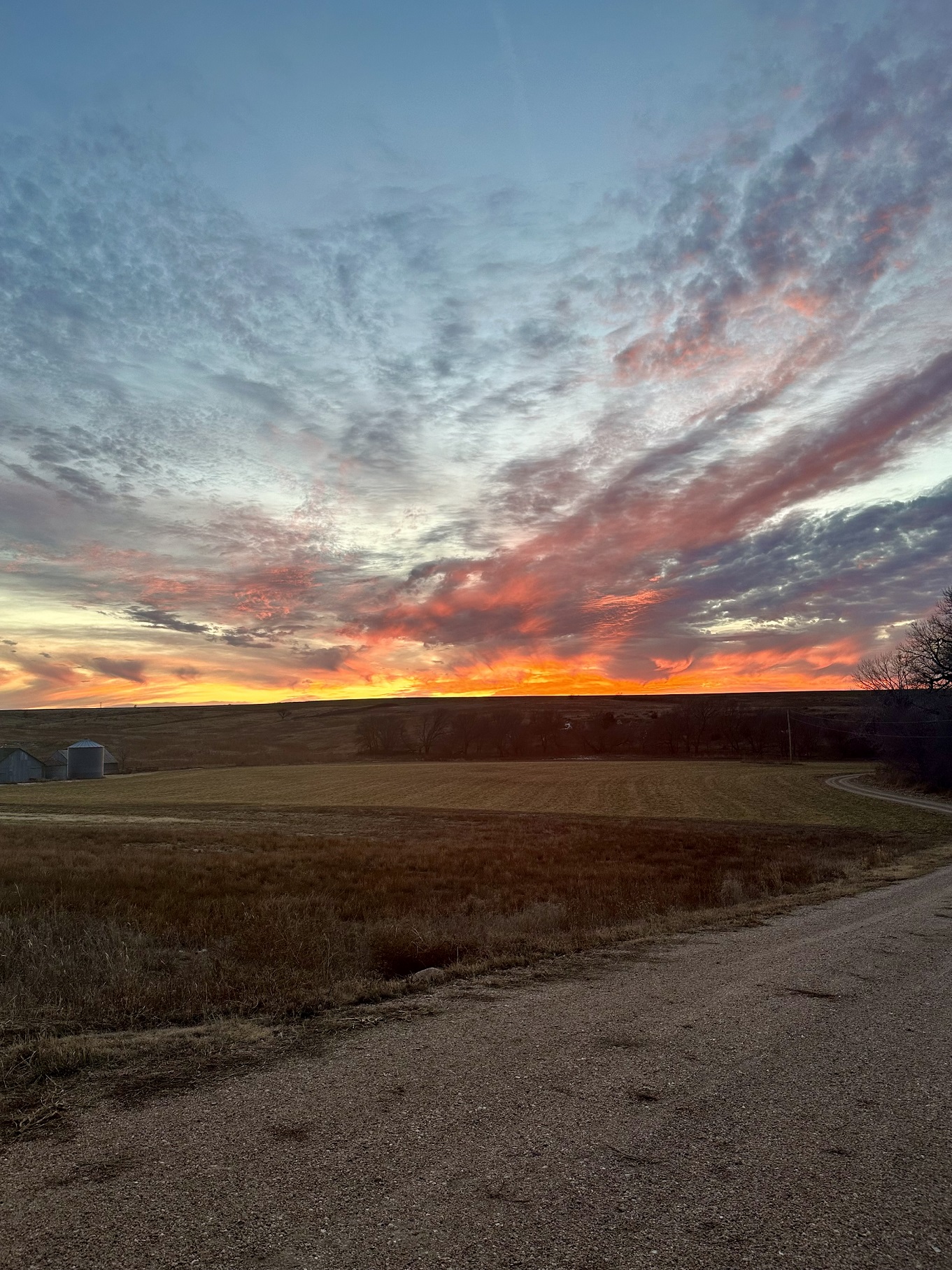
Silage Harvest in Kansas, Photo Courtesy of Gannon Rush
Hot and Dry Conditions Continue into July
The hot and dry conditions that started at the end of June carried over into July. Temperatures were well above normal for much of the month before finally cooling off. While precipitation was spotty, the amounts were plentiful in areas that received it.
The ongoing drought has taken its toll on agricultural conditions, particularly in Kansas and Nebraska. Corn was rated 33 percent and 22 percent poor to very poor, respectively. Farmers in western Kansas have started filing for crop insurance due to poor expected yields. Sorghum is a fairly drought-resistant crop, however, over 30 percent is rated poor to very poor in both states. Pasture and range conditions are also struggling, with over 30 percent rated very poor in both states. With a lack of feed, there has been a surge in cattle sell-offs.
Temperatures this month were excruciatingly hot, with several locations in the southern part of the region breaking all-time average temperature records. The following stations all have data going back to the 1800s. In Colorado, Castle Rock and Fort Collins surpassed their records on the 19th, while Fort Morgan did so on the 2nd. Scottsbluff, Nebraska broke its record on the 18th and Dodge
City had an average temperature of 94.5 degrees (34.7 degrees C) on the 15th to tie the record.


produced by the High Plains Regional Climate Center and are available at: http://hprcc.unl.edu/maps/current
Precipitation
Precipitation across the region was sporadic this month, however, locations that did receive rainfall in July were well above-normal. Drought-afflicted areas such as southwestern Nebraska and western Kansas continued to be below normal.
Precipitation was plentiful in the northern parts of the region, with several locations ranking in the top 10 wettest Julys. Huron, South Dakota, received 6.52 inches (16.56 cm) ranking 2nd wettest, while Dickinson,
North Dakota, recorded 4.39 inches (11.15 cm) to place 4th. The southwest monsoon brought much-needed precipitation, with 5.35 inches (13.59 cm) observed in Colorado Springs, Colorado, to rank 5th wettest.
It was a relatively quiet month for severe storms for the region, aside from another derecho in South Dakota on the 5th of July. Much of the precipitation in Huron occurred from this storm, with 5 inches (12.7 cm) re- ported by a nearby CoCoRaHS observer. Notable impacts included a 99 mph (159 km/h) wind gust near Howard and the presence of ominous green skies over Sioux Falls.


precipitation in inches (bottom) for July 2022. These maps are produced by HPRCC and can be found on the Current Climate Summary
Maps page at: http://hprcc.unl.edu/maps/current
Streamflow Update
Streamflow throughout the region was generally in good shape. Heavy precipitation led conditions in northeastern South Dakota and eastern North Dakota to have much above normal streamflow with some flooding expected. Conditions in southwestern Nebraska and western Kansas continued to be much below normal. Annual runoff above Sioux City is 80% percent of normal due to the long-term effects of drought.
Temperatures
The trend of above-normal temperatures continued into July. Much of the region experienced temperatures 2 to 4 degrees F (1.1 and 2.2 degrees C) above normal. Temperatures were scorching hot throughout most of July, with relief finally coming towards the end of the month.
Once again, western Kansas experienced the warmest temperatures throughout the region. Many days were well above 100 degrees (56 degrees C), with a station near Ashland recording 20 days above 100 degrees F. In central South Dakota, temperatures reached an incredible 114 degrees F (63 degrees C) on the 18th.
Along the front range of the Rockies, Denver recorded its 2nd warmest July and the 2nd warmest month on record. The average temperature in July was 78 degrees F (43 degrees C). Nearby Cheyenne, Wyoming, observed their 4th warmest July on record with an average temperature of 73.4 degrees F (40.8 degrees C). This also ranked as the 4th warmest month on record.

normals values in Ashland, Kansas.
Drought Conditions
Warm and dry conditions throughout much of the month led to the intensification of drought conditions in the southern part of the region. Overall, there was a 3 percent increase in moderate to exceptional (D1-D4) drought in July. North Dakota continues to remain drought-free.
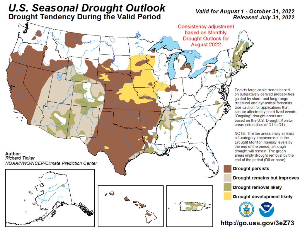
Numerous days of extreme heat and a lack of precipitation led to a significant increase in drought conditions across western Kansas. Most notably, D4 increased 7 percent by the end of July and 25 percent of the state is experiencing extreme to exceptional (D3-D4) drought. Nebraska and Wyoming also experienced intensification, with D3 conditions increasing 5 and 3 percent, respectively. Drought conditions did improve in the southwestern parts of Colorado, however, they deteriorated along the Front Range. Elsewhere in the region, other improvements and degradation were observed. According to the Climate Prediction Center’s U.S. Monthly Drought Outlook for August, drought improvement is likely across much of Colorado, western Kansas, and southern Wyoming, while development is likely in eastern Nebraska.

Department of Agriculture (USDA), National Drought Mitigation
Center, U.S. Department of Commerce, and the National Oceanic and
Atmospheric Administration (NOAA). For current Drought Monitor
information, please see: http://droughtmonitor.unl.edu/
Climate Outlooks
According to the Climate Prediction Center, La Niña conditions are likely to continue through the end of the year. A La Niña advisory is currently in effect. For more information, visit https://www.cpc.ncep.noaa.gov/products/analysis_monitoring/lanina/enso_evolution-status-fcsts-web.pdf
The National Weather Service’s long-range flood outlook indicates a high chance of Major Flooding in northeastern South Dakota through September. According to the National Interagency Fire Center (NIFC), fire potential will be limited to western Nebraska, western South Dakota, and eastern Wyoming through November.
The seasonal temperature and precipitation outlook presented below combine the effects of long-term trends, soil moisture, and when applicable, the El Niño Southern Oscillation (ENSO). To learn more about these outlooks, please visit http://www.cpc.ncep.noaa.gov.
Temperature
The three-month temperature outlook shows an increased chance of above-normal temperatures across the majority of the United States. Equal chances of above-, below-, and near-normal are present in North Dakota and northern South Dakota, otherwise, above-normal temperatures are favored.

Precipitation
The outlook for the next three months indicates below-normal precipitation across central parts of the United States. Across the High Plains there are equal chances of above-, below-, and near-normal precipitation in North Dakota. The rest of the region has increased chances of below-normal precipitation.

Drought
The U.S Seasonal Drought Outlook released on June 30th indicates drought conditions are expected to improve in Colorado and southern Wyoming. Opposite of this, drought development is likely in parts of South Dakota, Nebraska, and Kansas.

Station Summaries: By the Number


Download PDF Below


