Regional- Significant Events for December 2021- February 2022
Highlights for the Basin
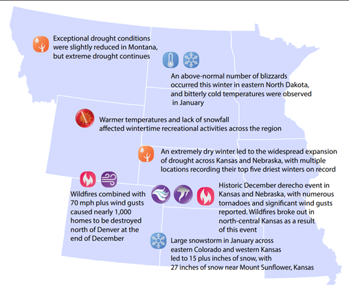
It was a very dry winter throughout most of the Missouri River Basin, especially in the southern portions. The 8th driest February and 10th driest winter on record for the Basin. Nebraska and Kansas observed their 4th and 5th driest winter, respectively. February was very dry, with Wyoming recording their 4th driest and Nebraska recording their 2nd driest month on record. December was a very warm month in the Basin. Kansas and Nebraska observed their warmest December on record, while Colorado and Wyoming observed their 2nd and 9th, respectively. Drought coverage expanded greatly across much of the lower basin. Lincoln, Nebraska recorded its 2nd driest
and lowest snowfall this winter.
Regional- Climate Overview for December 2021- February 2022
Temperature and Precipitation Anomalies
Winter temperatures were above normal for the majority of the Missouri River Basin. December was warm across most of the Basin. Both Kansas and Nebraska observing their highest maximum temperatures on record. Temperatures were closer to normal throughout the rest of the winter.
Precipitation was mostly below normal in the mountains and plains. The exception was eastern North Dakota with well above normal precipitation and snowfall. Many counties in northern Kansas and Nebraska ranked among their driest winters on record. Mountain snowpack for the upper Missouri Basin is approximately 80-85% of normal. This precipitation pattern is consistent with historical La Niña conditions.
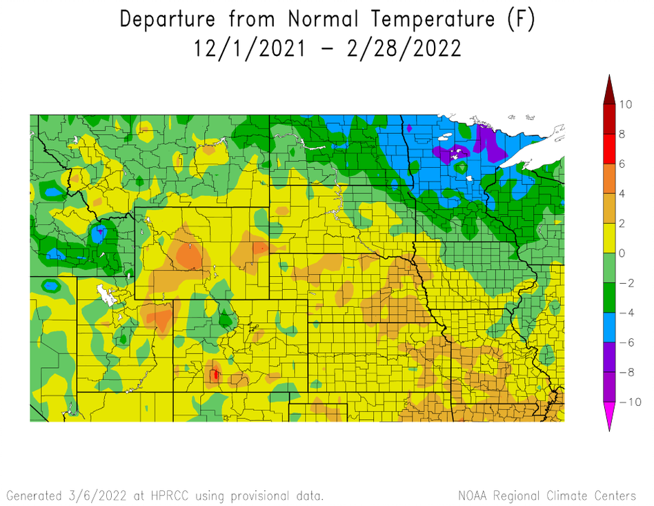
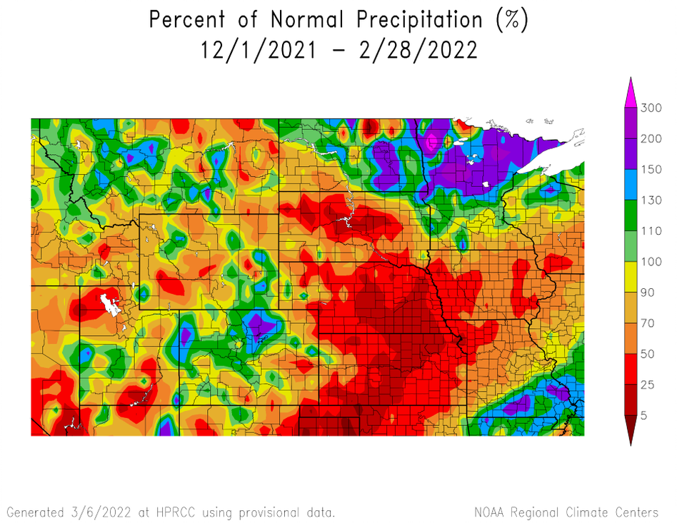
and Percent of Normal Precipitation (bottom) for Winter 21-22
Changes in Drought Conditions
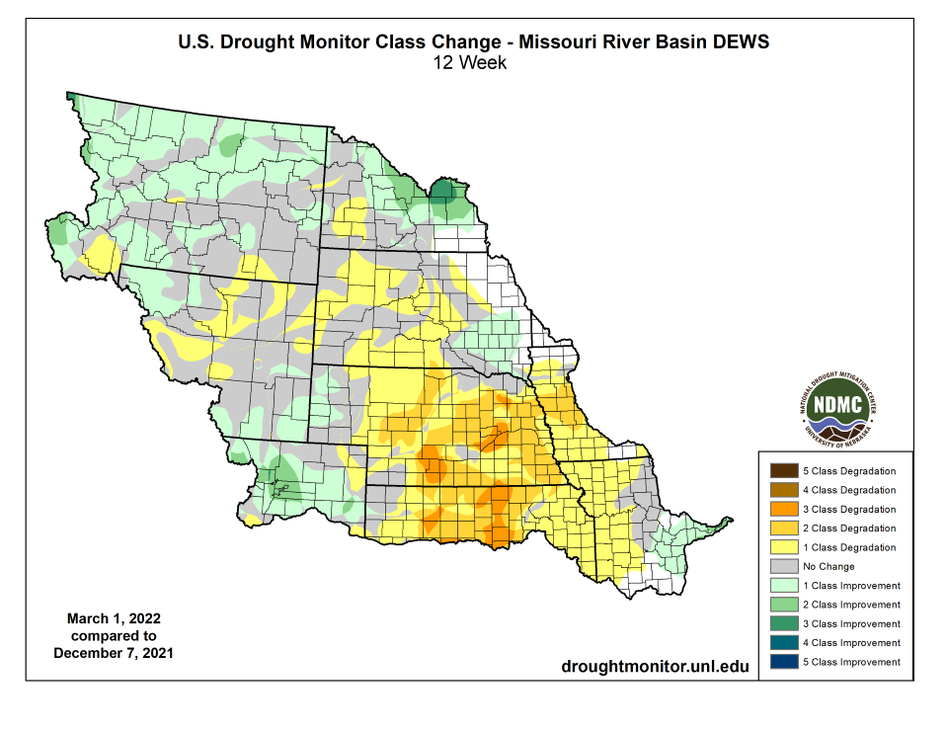
Drought continued through the winter, with conditions deteriorating up to 3 levels in Kansas and Nebraska. Over 98 percent of Nebraska and 73 percent of Kansas are in drought at the end of February. Despite the dryness in the southeastern part of the region, conditions improved slightly in Montana and eastern North Dakota. The worst category of drought was reduced over 29 percent in Montana.
Dec. 7, 2021 – Feb. 28, 2022
Regional- Impacts for December 2021- February 2022
Wildfires
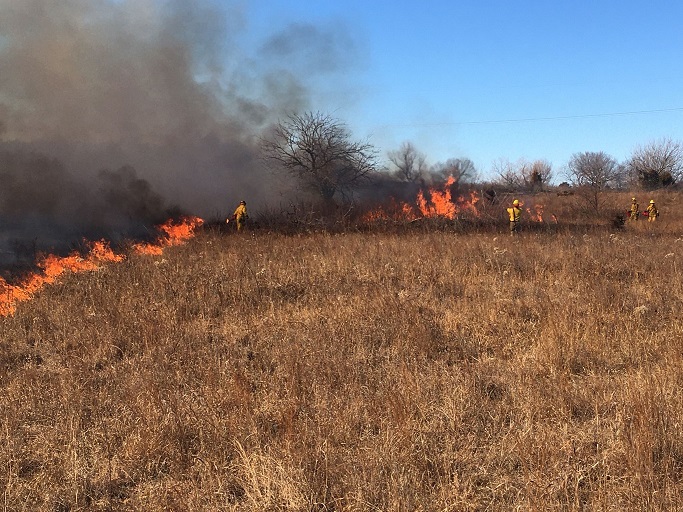
Several destructive wildfires broke out in December. The most destructive fire in Colorado history broke out on December 30th in Marshall. Aided by gusts of up 100 mph, over 1,000 homes were destroyed causing over $1 billion dollars in damage. In addition, High winds on December 15th led to multiple wildfires in north-central Kansas that burned over 160,000 acres. Two people and hundreds of cattle perished.
Recreation
Snow drought conditions and fluctuating temperatures this winter
led to decreased recreational activities in the lower elevations and plains. Snow making for skiing suffered in the Black Hills especially in December due to warm temperatures. A lack of stable lake ice, from varying temperatures, led to more limited ice fishing.

Water Resources
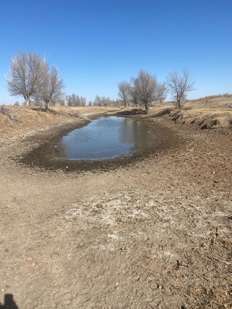
Low precipitation throughout most of the basin impacted water resources. Drought has lowered the Missouri River Mainstem Reservoir System and led to drought conservation measures to be implemented. This will impact navigation in 2022. Also, stock ponds for cattle have not recovered due to limited precipitation and runoff. Recharging these ponds will be difficult without substantial rain events this spring.
Regional- Outlook for April- June 2022
The outlook for April through June indicates increased chances of above normal temperatures and below-normal precipitation for the southern and central portions of the region. Equal chances of above, below, and near normal temperatures and precipitation are favored across North Dakota and eastern Montana. The only area with increased chances of below-normal temperatures is in northwest Montana. Based on outlooks, drought conditions are likely to persist for much of the basin, especially in areas where below-normal precipitation and warmer than average temperatures are more likely. Currently, La Niña influences will continue through the summer.
Temperature
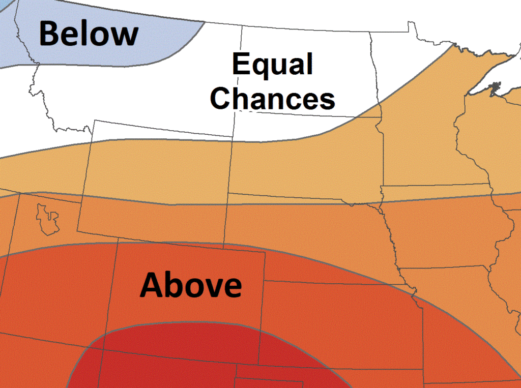
A: Above normal, B: Below normal
Precipitation
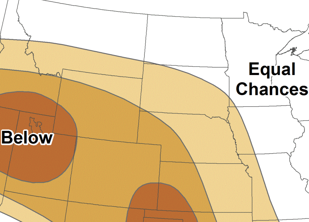
A: Above normal, B: Below normal
MO River Basin Partners
High Plains Regional Climate Center
www.hprcc.unl.edu
National Integrated Drought Information System
https://www.drought.gov/
NOAA NCEI
www.ncdc.noaa.gov
NOAA NWS – Central Region
www.weather.gov/crh
NOAA NWS Climate Prediction Center
www.cpc.ncep.noaa.gov
NOAA NWS Missouri Basin River Forecast Center
www.weather.gov/mbrfc
American Association of State Climatologists
https://www.stateclimate.org/
U.S. Army Corps of Engineers
www.nwd-mr.usace.army.mil/rcc/
U.S. Bureau of Reclamation
https://www.usbr.gov/
USDA Natural Resources Conservation Service
www.nrcs.usda.gov
USDA Northern Plains Climate Hub
www.climatehubs.oce.usda.gov
Bureau of Indian Affairs – Great Plains Region
www.bia.gov/regional-offices/great-plains
National Drought Mitigation Center
http://drought.unl.edu/
Download PDF below
