September 2021 Climate Summary
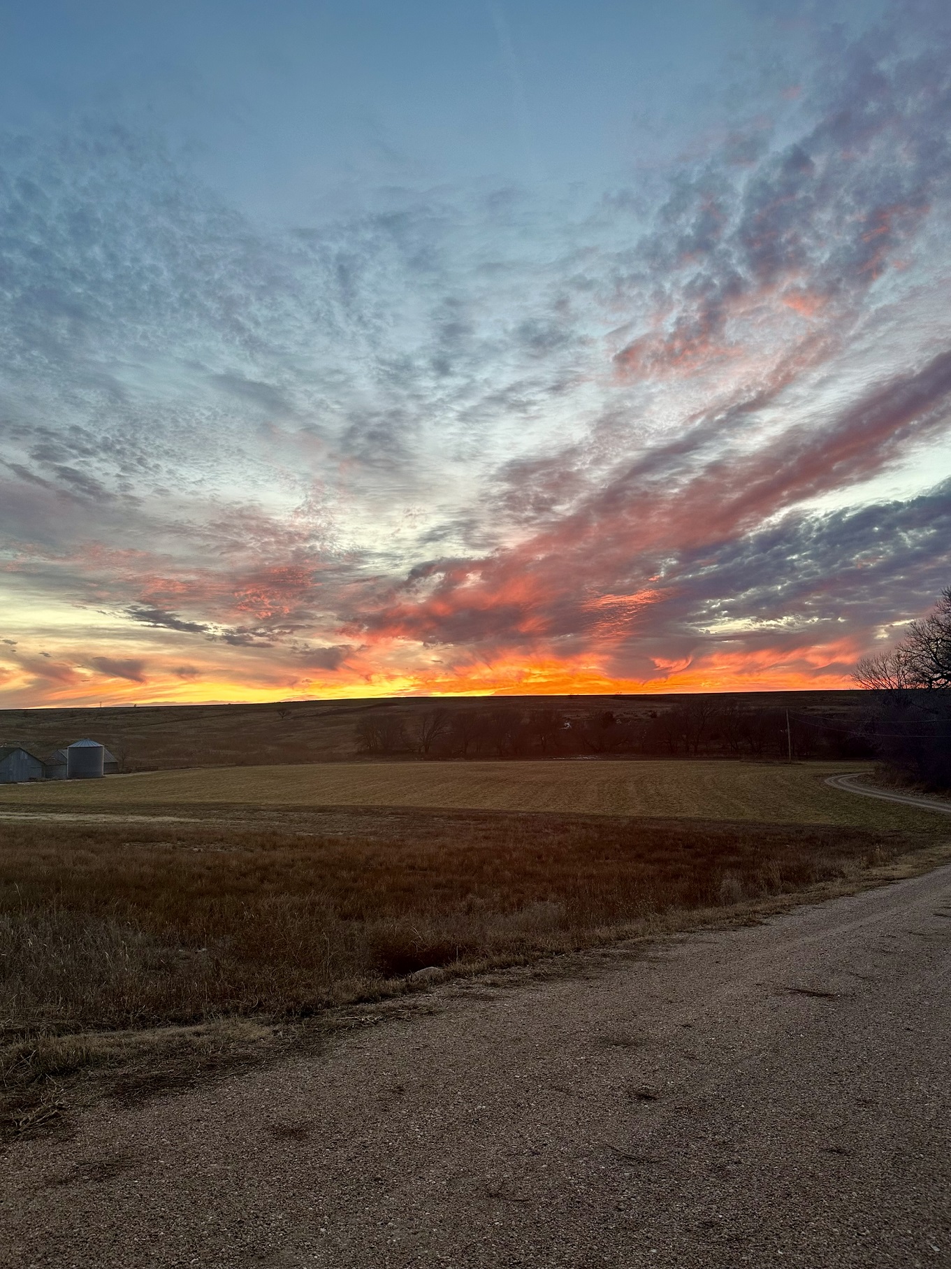
Storm Clouds in SD, Photo courtesy Alex Resel
Much Needed Precipitation and Cooler Temperatures
Much needed precipitation in some portions of the region has helped to provide minor relief to drought conditions and restored streamflow. Precipitation in areas of South Dakota, Nebraska, and Kansas were as much as 150 percent above normal for the month. South Dakota, which began the month with 64.69 percent of the state in D3-D4 drought conditions, has observed some minor improvements and ended the month with 58.62 percent in D3-D4 drought conditions. Despite these minor improvements, the scope of the drought is so extreme that it will continue to take a notable amount of precipitation to see any relief in these regions. Precipitation also aided in streamflow conditions in the eastern portion of the region. Streamflow across the Dakotas and lower basin returned to normal and some even observed much above normal streamflow.
Cooler temperatures also aided in relief across portions of the region. Firefighters took advantage of the cooler temperatures in September and were able to expand containment of the Crater Ridge Fire in Wyoming from 35 to 52 percent. As a result, air quality across the state has improved compared to earlier in the summer. While these fires continue to be a concern in Wyoming, wildland fire potential will begin to decrease throughout October and return to normal in November.
Higher elevations in Wyoming and Colorado observed their first snow for the season in September. A dusting was observed in Northwest Colorado near Rabbit Ears Pass and Cameron Pass. Light snow was also observed in Rocky Mountain National Park and even resulted in road closures due to whiteout conditions from blowing snow. In Wyoming, a light blanket of snow was observed in Grand Teton and Yellowstone National Park. While neither were measurable events, cooler temperatures are on the way as we continue into fall.


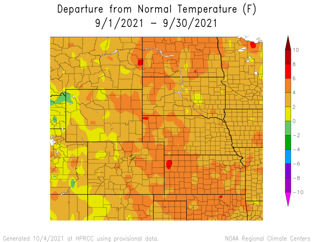
Above: Departure from 1991-2020 normal temperature (left) and percent of normal precipitation (right) for September 2021 in the High Plains region.
Maps produced by the High Plains Regional Climate Center and are available at: http://hprcc.unl.edu/maps/current
Precipitation
Precipitation varied for September but remained at or near normal across most of the region. With precipitation near-normal, only a few areas ranked in the top 10 wettest or driest on record for September (see page 6 for monthly rankings). Portions of eastern South Dakota, central Nebraska, and Kansas received the greatest departure from normal with total precipitation as much as 2 to 3 inches (50.80 to 76.20 mm) above normal for the month. Valentine, NE observed 4.01 inches (101.85 mm) for the month ranking it the 5th wettest September on record, with the wettest being 5.91 inches (150.11 mm) set in 1973. This was also 233 percent above normal for the month. The above normal precipitation across central Nebraska slowed corn harvest ending the month with 21 percent of the corn being harvested. Corn harvest, which has been impacted due to the drought, began early harvest this year in September. However, this much needed precipitation across the region did help to provide some minor improvements to drought conditions, most of which was observed in South Dakota, and helped return streamflow in most of the region to normal and above normal.
In contrast to the above normal precipitation, portions of Wyoming and North Dakota observed slightly below normal precipitation and ranked in the top 10 driest for the month. Sheridan, WY, which received 13 percent of normal precipitation, ranked the 2nd driest September on record with a total on 0.04 inches (1.02 mm) of precipitation (the driest record being a trace recorded in 2012). Williston, ND also ranked in the top 10. Williston observed 0.10 inches (2.54 mm) for September ranking it the 7th driest on record (the driest record being 0.01 inches, 0.25mm, recorded in 1899). This lack of precipitation has impacted wetlands in North Dakota. As a result, North Dakota’s duck hunters are observing poor wetland conditions which will impact the duck hunting season. The number of duck hunting wetlands are down 44 percent across the state from last fall as a result of the lack of precipitation and drought conditions.


Above: Total precipitation in inches (left) and departure from normal
precipitation in inches (right) for September 2021. These maps are
produced by HPRCC and can be found on the Current Climate Summary Maps page at: http://hprcc.unl.edu/maps/current
Streamflow Update
Streamflow across the region continued to vary for September. Precipitation in the eastern portion of the region helped streamflow in the lower half of the basin return to normal. This precipitation also led to areas in Kansas, Nebraska, and North Dakota observing above to much above normal streamflow. In contrast, most of Montana, Wyoming, and the western portions of the Dakotas still remain below to much below average for streamflow, aside from some isolated areas that are seeing normal flows. Multiple streams in Montana and Wyoming have also observed record low flow for the month
Temperatures
Temperatures remained slightly above normal across the region for September aside from a small area in western Wyoming that observed below normal temperatures. The highest departures from normal were observed in North Dakota, Kansas, western South Dakota and Nebraska, and eastern Wyoming and Colorado. These areas observed temperatures over 4.0 degrees F (2.2 degrees C) above normal for September.
As a result of these above-normal temperatures, many locations ranked in the top 5 warmest September on record. Chadron, NE tied a previous record set in 1969 for the warmest September on record with an average temperature of 67.0 degrees F (19.4 degrees C) which was 4.2 degrees F (2.3 degrees C) above normal. Five other cities, located in Nebraska, North Dakota, and Colorado, observed the 2nd warmest September on record (see page 6 for monthly rankings).
Warm temperatures in the region at the end of the month resulted in many areas in North Dakota surpassing daily temperatures records, including Dickinson, ND with a record of 100.0 degrees F (37.8 degrees C) on the 28th of September surpassing a record of 98.0 degrees F (36.7 degrees C) set in 1905. This also is the latest in the year any station in North Dakota has reached 100.0 degrees F (37.8 degrees C) or higher. Bismarck, ND also reached its 50th day this year with a high temperature equal to or above 90.0 degrees F (32.2 degrees C), the record being 53 days set in 1936. Despite these high temperatures, some minor improvements were seen in drought conditions throughout September in North Dakota and other areas within the region.

and normals values in Chadron, NE
Drought Conditions
Dry weather across the High Plains led to the continued spread of drought and abnormally dry (D0 – D4) conditions. Areas experiencing D0-D4 conditions increased from 80 to 86 percent over the month of September. Despite the increase, areas experiencing extreme and exceptional drought (D3-D4) conditions decreased 3 percent across the region
The drought that has gripped the Dakotas finally saw relief in the month of September. In South Dakota, the areas experiencing D3-D4 were reduced 16 percent during the month. D4 was reduced 5 percent in North Dakota, with only a small margin of the state still under D4 conditions. Despite the improvements in the northern part of the region, the southern portions saw an increase in drought and abnormally dry conditions. Wyoming experienced a 10 percent increase in severe to exceptional drought (D2-D4) conditions. Recent dryness has impacted Colorado, with the state experiencing a 37 percent increase to D0-D4 conditions during the month of September. Throughout the rest of the region, other minor adjustments were made. According to the U.S. Monthly Drought Outlook for October, drought removal is likely across Nebraska

The U.S. Drought Monitor is produced as a joint effort of the U.S.
Department of Agriculture (USDA), National Drought Mitigation
Center, U.S. Department of Commerce, and the National Oceanic and
Atmospheric Administration (NOAA). For current Drought Monitor
information, please see: http://droughtmonitor.unl.edu/
Climate Outlooks
According to the Climate Prediction Center, ENSO-neutral conditions continued for the month of September. However, a transition to La Niña conditions is possible in the next few months, lasting throughout the winter, and a La Niña watch has been issued. For more information, visit https://www.cpc.ncep.noaa.gov/products/analysis_monitoring/lanina/enso_evolution-status-fcsts-web.pdf
The National Weather Service’s long-range flood outlook through December indicates a less than 50 percent chance of river flooding for much of the region with a small area in the lower basin with 50 to 80 percent chance of minor flooding. According to the National Interagency Fire Center (NIFC), above-normal wildland fire potential is expected for most of Wyoming, and a small portion of South Dakota and Colorado through October. The wildland fire potential is expected to return to normal in November.
The seasonal temperature and precipitation outlooks below combine the effects of long-term trends, soil moisture, and when applicable, the El Niño Southern Oscillation cycle (ENSO). To learn more about these outlooks, please visit http://www.cpc.ncep.noaa.gov.
Temperature
The temperature outlook for the next three months shows an increased chance for above normal temperatures for most of the contiguous United States. The Southwest and Northeastern portions of the United States have the highest chances for above-normal temperatures. In the southern High Plains, there is a slightly increased chance of above-normal temperatures for the next three months, whereas in the Northern High Plains there are equal chances of above-, below-, and near-normal temperatures.

Precipitation
The precipitation outlook for the next three months indicates below-normal precipitation stretching across the southern half of the United States with a portion stretching into the High Plains. The highest chances of below-normal precipitation are present in Texas, New Mexico, and parts of Arizona, Utah, Colorado, Kansas, and Oklahoma. In the High Plains, there is a slightly increased chance of below-normal precipitation, aside from North Dakota and portions of Wyoming and South Dakota that have equal chances of above-, below-, and near-normal precipitation.

Drought
The U.S Seasonal Drought Outlook released on September 16th indicates drought conditions are expected to persist in the Western U.S and Northern Plains over the next three months. Drought conditions will remain in the Northwest with some minor improvements likely. In portions of southern Nebraska, eastern Colorado, Kansas, Oklahoma, and Texas, drought development is likely.

Above: The three-month temperature probability outlook (top), the
three-month precipitation probability outlook (middle), and the U.S.
Seasonal Drought Outlook (bottom). For more information on these
outlooks, produced by the Climate Prediction Center, see:
http://www.cpc.ncep.noaa.gov
Station Summaries: By the Numbers


Download PDF version below.


